
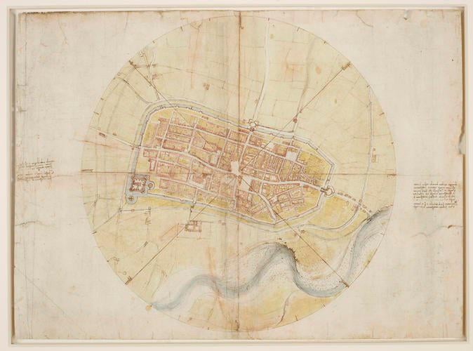
In August 1502 Leonardo Da Vinci was appointed ‘General Architect& Engineer’ to Cesare Borgia, son of Pope Alexander VI and marshal of the papal troops. Cesare lodged in Imola in the autumn of 1502, and it must have been then that Leonardo made this map of the town [674×500]
by Remote_Finish_9429
3 Comments
[source](https://www.rct.uk/collection/search#/10/collection/912284/a-map-of-imola) A drawing of a map of Imola, showing the city enclosed by a ring. Four lines cross the plan, forming on the circle eight points of the compass, at which the names of the winds are written in Leonardo’s hand, clockwise from one o’clock.
Just a little context: this map was revolutionary in terms of both top-down drawing (maps used to be drawn from a birds-eye perspective) surveying and cartographical accuracy. The first of its kind, this map shows Da Vinci’s brilliance and genius as the principles he developed to make accurate maps like this were still in use hundreds of years later, right up until aerial photography and GPS.
As an archaeologist, surveyor and collector of historical maps, this map of Imola has a special place in my heart.
As someone always in search of historical city maps to use in wargaming and TTRPGs, let me be the first to say *”yoink”*.