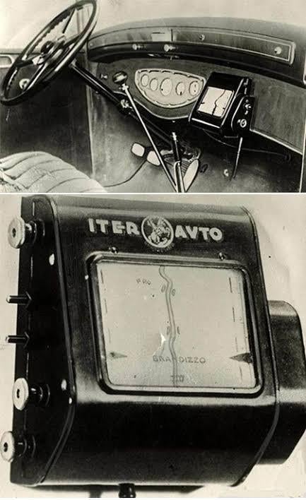
Developed in Italy, this device didn’t use satellites (which obviously didn’t exist yet). Instead, it was physically tethered to the car’s speedometer. As the car moved, the mechanical cable rolled a paper map across the screen at a speed proportional to the vehicle’s pace.
If the driver made a wrong turn or left the designated route, the device had no way of knowing, forcing the driver to manually adjust or change the map roll.
[deleted] on
[deleted]
RedizeYT on
Reckon it could’ve been a bit more useful if it correlated to the steering of the wheel. Could’ve had a mechanism to turn the map/rotate it with the steering wheel. But still massively cool.

3 Comments
Developed in Italy, this device didn’t use satellites (which obviously didn’t exist yet). Instead, it was physically tethered to the car’s speedometer. As the car moved, the mechanical cable rolled a paper map across the screen at a speed proportional to the vehicle’s pace.
If the driver made a wrong turn or left the designated route, the device had no way of knowing, forcing the driver to manually adjust or change the map roll.
[deleted]
Reckon it could’ve been a bit more useful if it correlated to the steering of the wheel. Could’ve had a mechanism to turn the map/rotate it with the steering wheel. But still massively cool.