
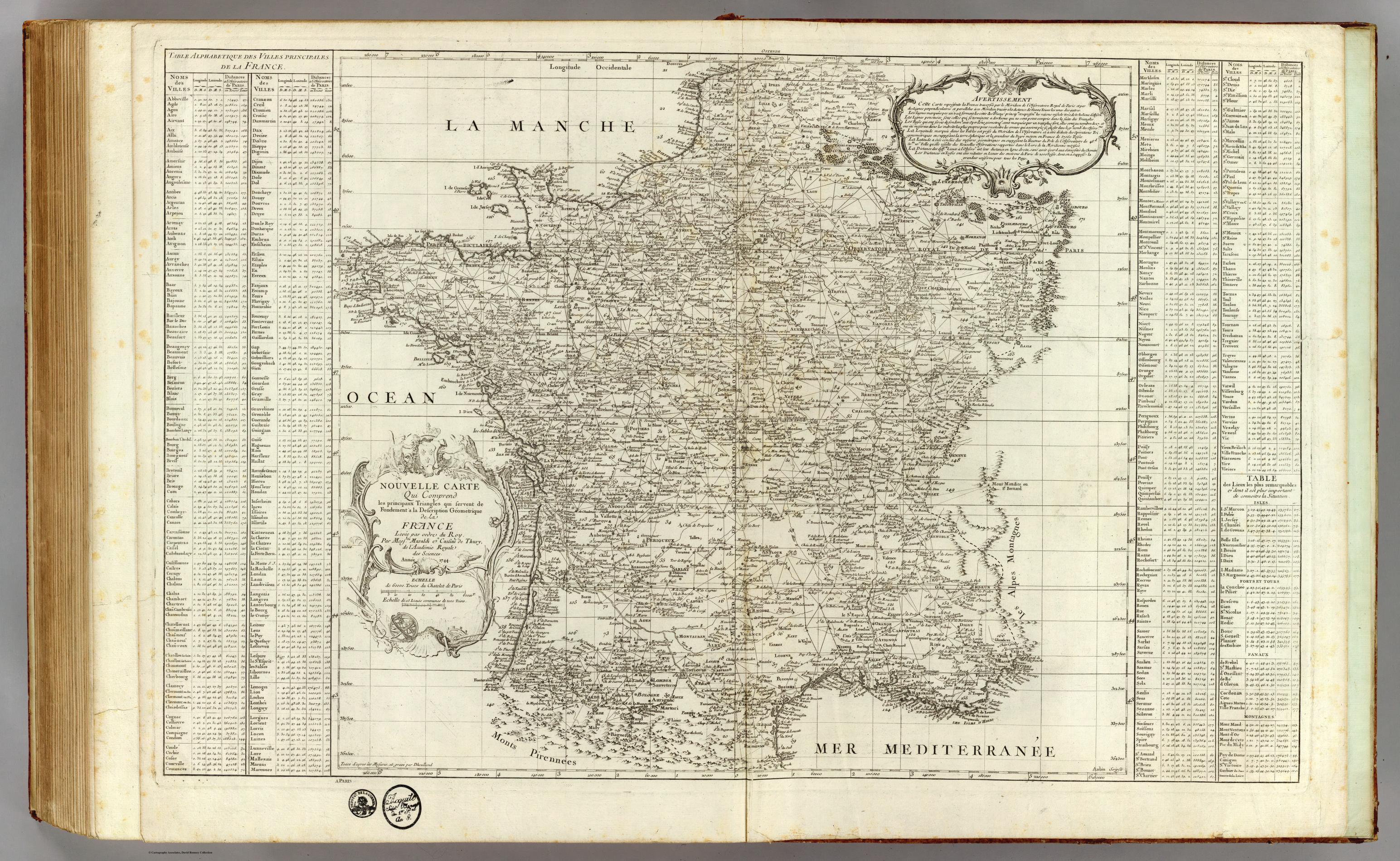
Over 100 years, four generations of the same family (the Cassinis) worked to create the first scientifically accurate map of an entire nation: France in the 1700s for King Louis 16th. Image is of the map they made.
by MaxiumPotential777
Over 100 years, four generations of the same family (the Cassinis) worked to create the first scientifically accurate map of an entire nation: France in the 1700s for King Louis 16th. Image is of the map they made.
by MaxiumPotential777
10 Comments
Links to view additional maps they made:
https://www.geoportail.gouv.fr/donnees/carte-de-cassini?hl=en-US
https://www.davidrumsey.com/luna/servlet/detail/RUMSEY~8~1~306303~90076679:Composite-Map–1-24–Carte-de-Franc
Downloading will allow one to view map in image in 4k.
Looks pretty fucking accurate.
I hate how it doesn’t include Basque Country which the French obtained during this period and had significant control of.
So he lived through 4 generations?
Is this the same Cassini family who had a member discovered right gap in Saturn’s rings?
Interesting to note the Meridian 0 is going through the Paris Observatory longitude. It wasn’t until the International Meridian Conference in 1884 than the Greenwich meridian was set as the international reference for longitude. So the longitude 0 in this map is actually 2°20′14.02500′′ East.
Interesting post, thank you for sharing!
Version control must have been a nightmare
Is the Cassini who discovered Sarurns moons (and is the namesake for the Cassini -Huygens spacecraft)?
why is there a paris in alsasse lorraine?
[Here](https://www.davidrumsey.com/luna/servlet/detail/RUMSEY~8~1~25804~1080047:France-?sort=pub_date%2Cpub_list_no_initialsort&mi=200&trs=208&qvq=w4s:/who%2FCarte%2Bde%2Bla%2BFrance%2BDirecteures%2FCassini%2Bfamily%2FCassini%2C%2BCesar-Francois%2C%2B1714-1784%2Fwhere%2FFrance;sort:pub_date%2Cpub_list_no_initialsort;lc:RUMSEY~8~1) is the source of this image where you can zoom in on it.
> Author:
Cassini, Cesar-Francois, 1714-1784
> Author:
Maraldi, Giovanni Domenico
> Date:
1744
> Short Title:
France.
> Publisher:
Carte de la France Directeures