
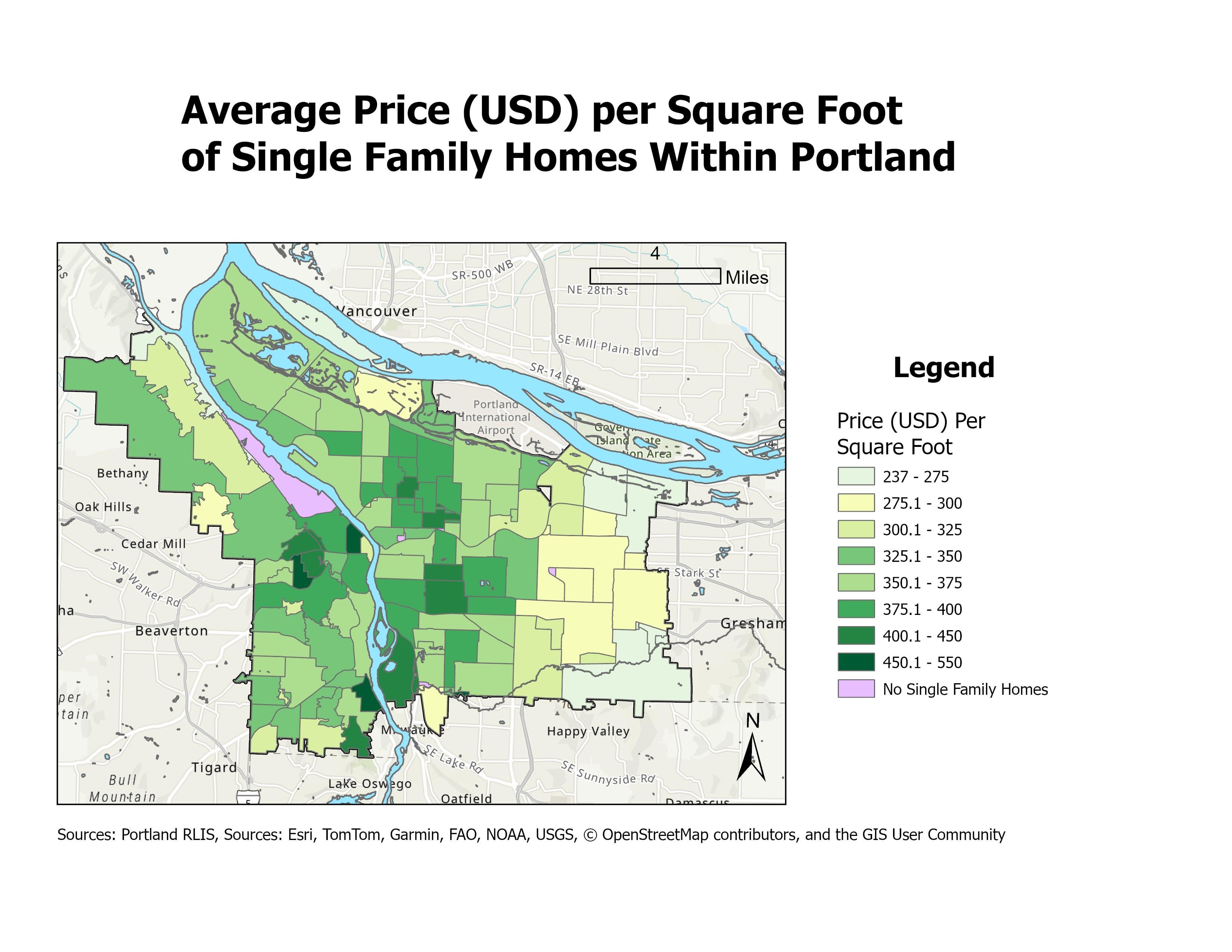
Hello! I'm currently in a GIS class, and I'm making some maps in my free time. This map utilizes data from Portland RLIS for both the neighborhood tracts as well as the tax lot data.
Tool Used: ArcGis Pro
Data Sources: Oregon Taxlot data by Portland RLIS, Portland Neighborhood Boundaries by Portland RLIS
For the nitty gritty, this data was collected by filtering the tax lots to state code 101 (land use doesn't always correspond to what it's being used as), then taking the average total value of each tract and dividing it by the average total square footage. The data appears to match up with Portland publicly available data, but feel free to call me out if I did anything wrong.
by UrbanAzalea