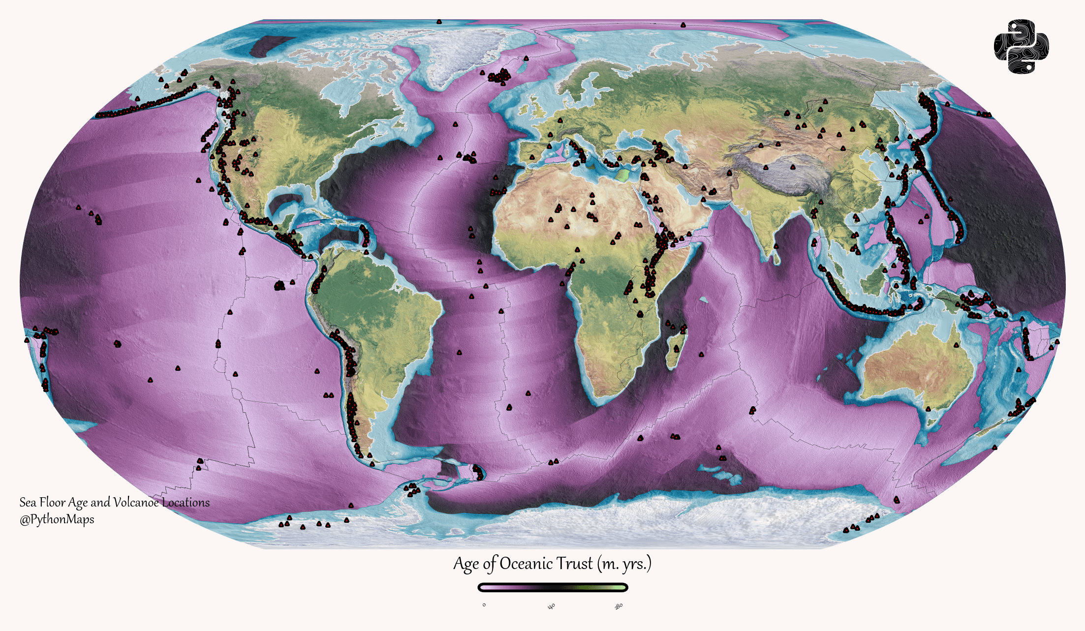
[OC] Mapping the age of oceanic crust, overlayed with the locations of the world’s volcanoes by symmy546
symmy546 on April 4, 2026 7:42 pm More can be found on my twitter – https://twitter.com/PythonMaps or Instagram. The data source is from NOAA, ‘Marine Geology and Geophysics Images of Crustal Age of the Ocean Floor’. I used GDAL, geopandas and rasterio for data processing and plotted the map using matplotlib / rasterio.

1 Comment
More can be found on my twitter – https://twitter.com/PythonMaps or Instagram.
The data source is from NOAA, ‘Marine Geology and Geophysics Images of Crustal Age of the Ocean Floor’. I used GDAL, geopandas and rasterio for data processing and plotted the map using matplotlib / rasterio.