
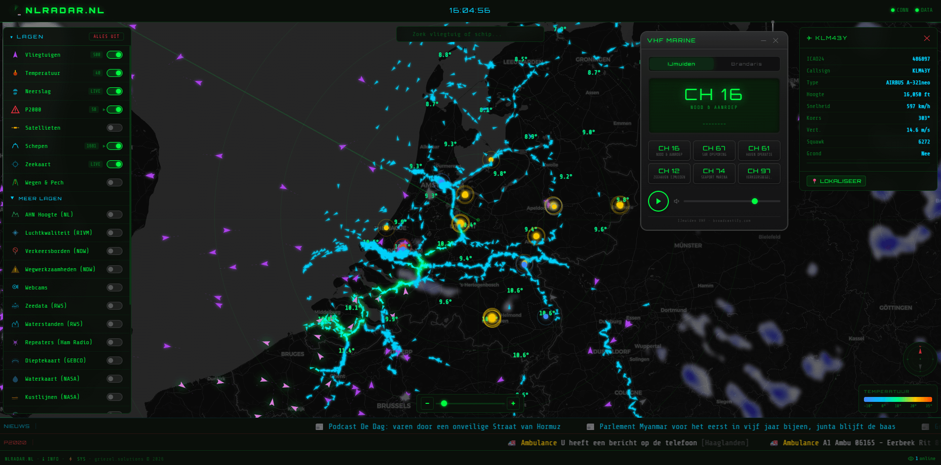
I built a map that combines several real-time public datasets for the Netherlands into one visualization.
Layers currently include:
- aircraft (ADS-B)
- ships (AIS)
- weather radar and stations
- P2000 emergency alerts
- traffic data
- satellites
- VHF
The idea was to see how much real-time infrastructure data could be visualized in a single map.
Suggestions for more data are really welcome 🙂
by Interesting-Proof734
6 Comments
Data sources include several public APIs such as ADS-B aircraft data,
AIS ship tracking, weather radar, weather stations, traffic feeds
and Dutch P2000 emergency alerts.
The visualization combines these real-time datasets into a single
interactive map using Leaflet and various APIs.
Full interactive version:
[https://nlradar.nl](https://nlradar.nl)
Why am I seeing so many maps like this coming out lately? Did it just get easier, or did you all come up with the idea at the same time?
We need allestoringen heatmap integration.
Every transit vehicle is tracked as well (bus, tram, metro, train), maybe add those?
Would be nice if the map was updated more frequently, especially the planes. Love the map, looks great!
This is fantastic! Noticed a small display error:
A1 &039#;s-Hertogenbosch Rit: 34022 (trailing “&039#;”)