
We just added this to our free urban visualizer tool civic mapper, here's the direct link to New York City:
https://www.civicmapper.org/parking.html?city=nycvvdfdfdf
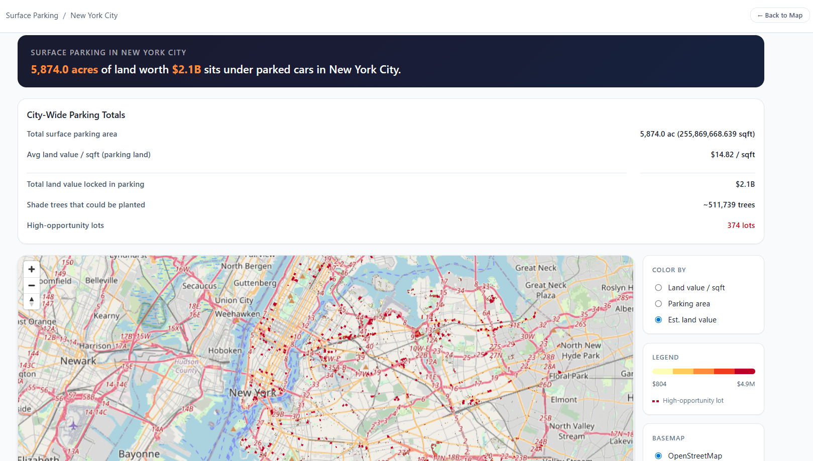
The land value data comes straight from New York City public data from the assessor's office. The parking lots are automatically identified using freely available public satellite imagery data paired with commodity computer vision algorithms we found on hugging face.
Not only does New York City have some of the most valuable real estate in the world, a lot of it is just sitting there as low value uses. This visualization makes it much easier to find and quantify this.
There is an open source version of civic mapper that includes the 3D visualization feature we showed before, but we have not yet released the parking lot identifier. The open source version is at www.putitonamap.com
by larsiusprime
3 Comments
>Shade trees that could be planted
Seriously? This is what you assume the land would be used for if the parking lot were removed?
Time to dig up Al Smith, make him governor again, let him reinstate his land value tax, and enter a new golden age
Please do this for LA or San Diego