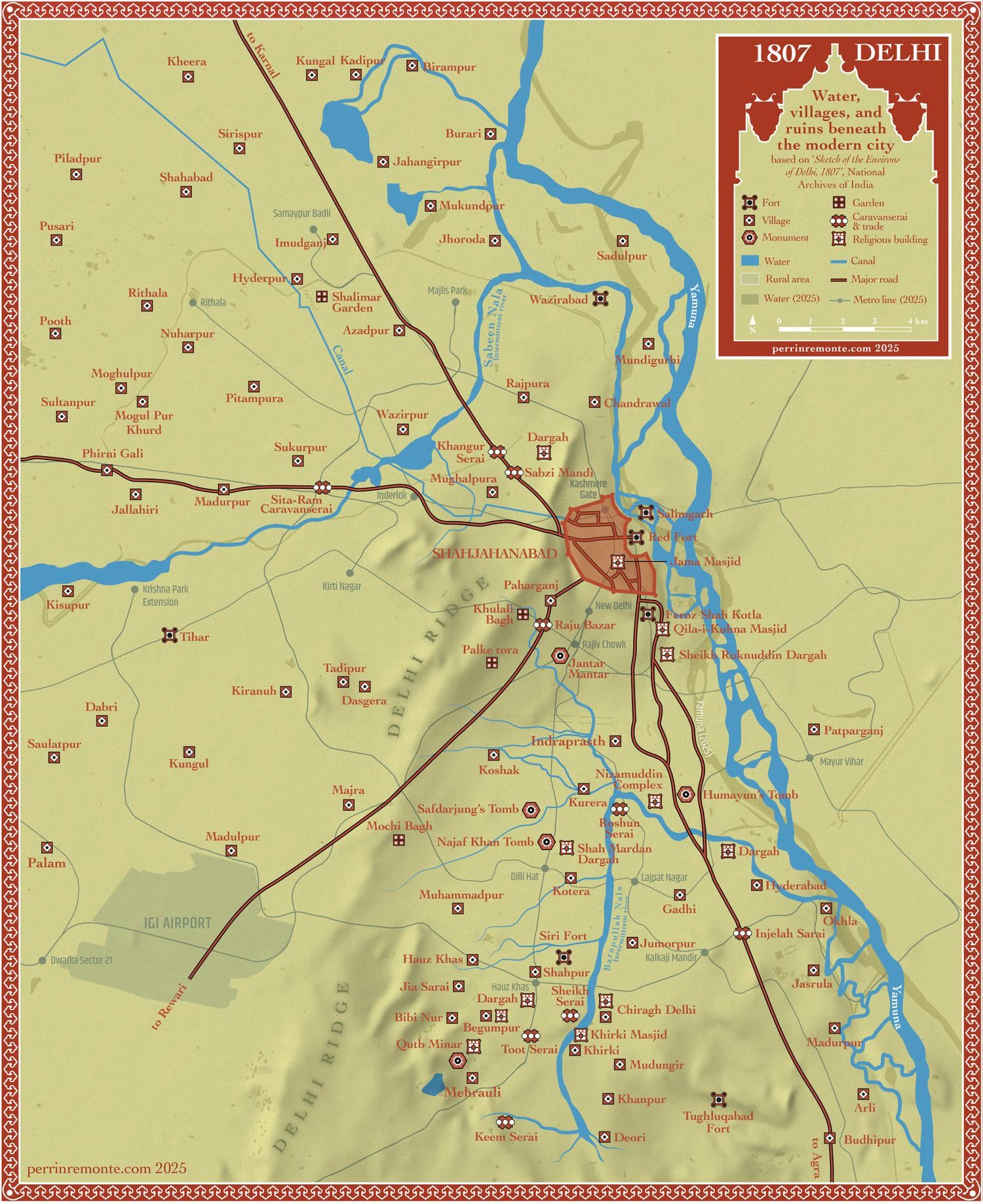
I superimposed the old map and today’s data using QGIS to achieve this result. I wanted to show the incredible urban spread that took over the 1807 Delhi region, a mediaeval walled city surrounded by sufi shrines, abandoned forts, caravanserais and villages spread across the Yamuna plains…
Today, most of the map is urban fabric, except for the hills you see in the centre: they’re the 2 billion year old Aravalli mountains. Reading about the history of Delhi is just mind blowing
I suggest reading « city of Djinns » from William Dalrymple for a very cool, interesting and brilliantly written introduction to the city and its history

1 Comment
Hi, French cartographer fascinated by the city of Delhi here!
The map was made using the 1807 sketch Delhi area (article [here](https://scroll.in/magazine/841320/six-delhi-maps-chart-the-citys-evolution-from-1807-to-2021))
I superimposed the old map and today’s data using QGIS to achieve this result. I wanted to show the incredible urban spread that took over the 1807 Delhi region, a mediaeval walled city surrounded by sufi shrines, abandoned forts, caravanserais and villages spread across the Yamuna plains…
Today, most of the map is urban fabric, except for the hills you see in the centre: they’re the 2 billion year old Aravalli mountains. Reading about the history of Delhi is just mind blowing
I suggest reading « city of Djinns » from William Dalrymple for a very cool, interesting and brilliantly written introduction to the city and its history
You can find the map here along with other map on my [website](https://www.perrinremonte.com/1807-delhi)!