
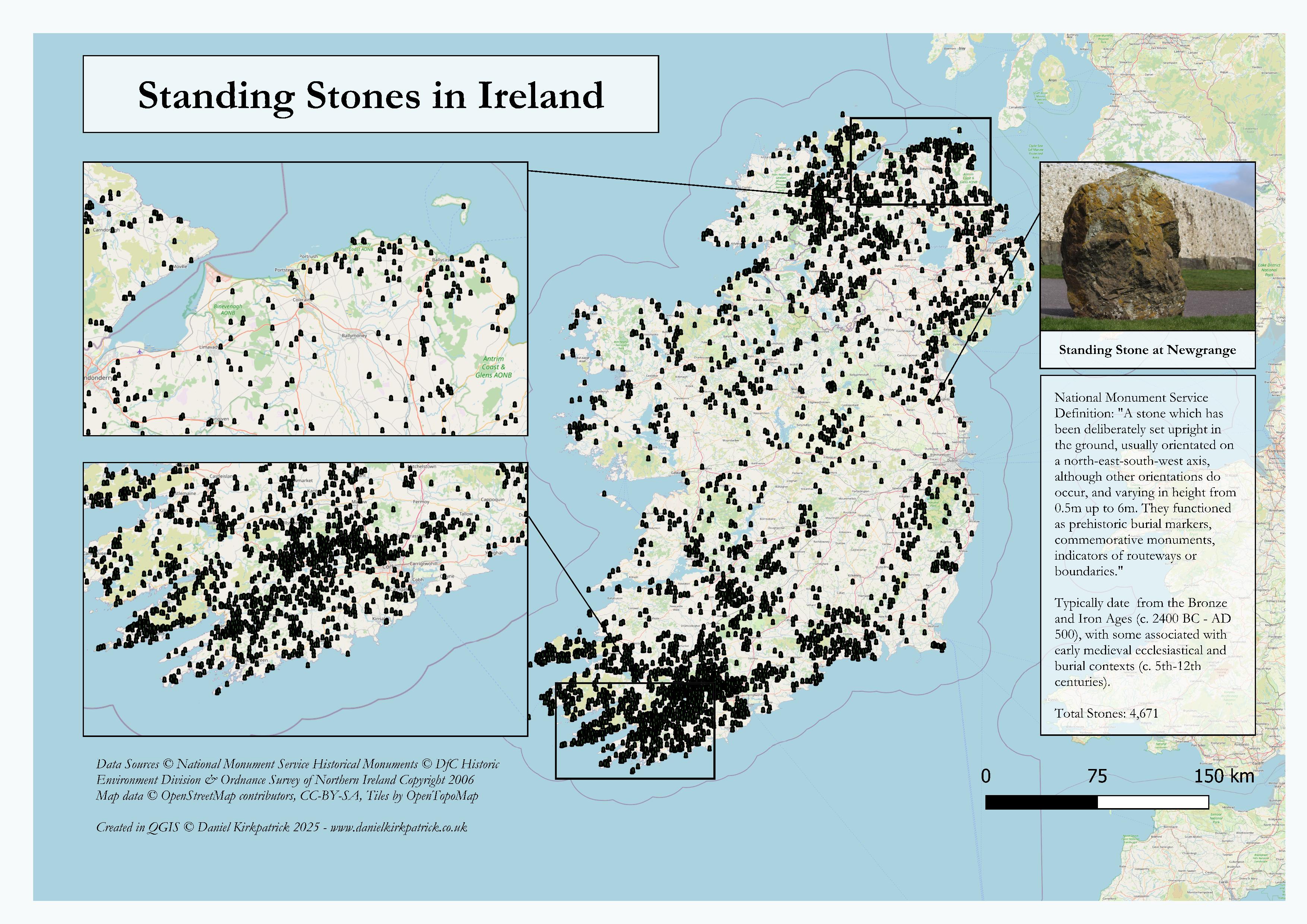
I've created this map showing the distribution of all standing stone locations across Ireland.
The map is populated with a combination of National Monument Service data (Republic of Ireland) and Department for Communities data for Northern Ireland. The map was built using some PowerQuery transformations and then designed in QGIS.
I previously mapped a bunch of other ancient monument types, the latest being rock art locations across Ireland.
This is the static version of the map, but I’ve also created an interactive map which I’ve linked in the comment below for those interested in more detail and analysis.
I've also created similar maps on this before but I've updated this one with an image to illustrate what it is showing based on feedback here before.
by Sarquin
2 Comments
For those who want to see the data sources check out [NMS here ](https://www.archaeology.ie/collections-and-publications/publications/monument-class-and-scope-notes/)and the [UK Open Data here](https://www.data.gov.uk/dataset/46240fa5-db15-469e-b1c8-0460504b951c/northern-ireland-sites-and-monuments-record). For the tooling, I used QGIS and PowerQuery (Excel).
You can also see my interactive map of standing stone locations along with their background here too: [https://www.danielkirkpatrick.co.uk/irish-history/standing-stones-ireland/](https://www.danielkirkpatrick.co.uk/irish-history/standing-stones-ireland/)
It’s a great map, really interesting to see the heavy density of stone in particular areas, Cork and Kerry border.
A question, does this map include circles of standing as well as individual stones? Just curious.
Thanks