Every step I took in 2024 mapped by GPS my entire year as a single visualization [OC]
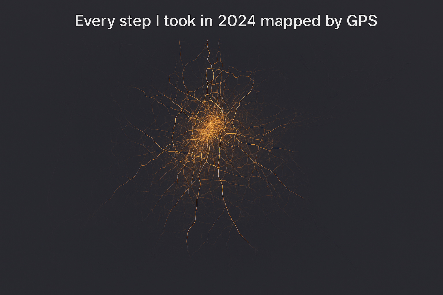
I exported my location history for the year and plotted all walking routes on one layered map.
Dark lines = paths I walked often.
Brighter lines = rare trips.
Generated with QGIS + heatmap overlay.