
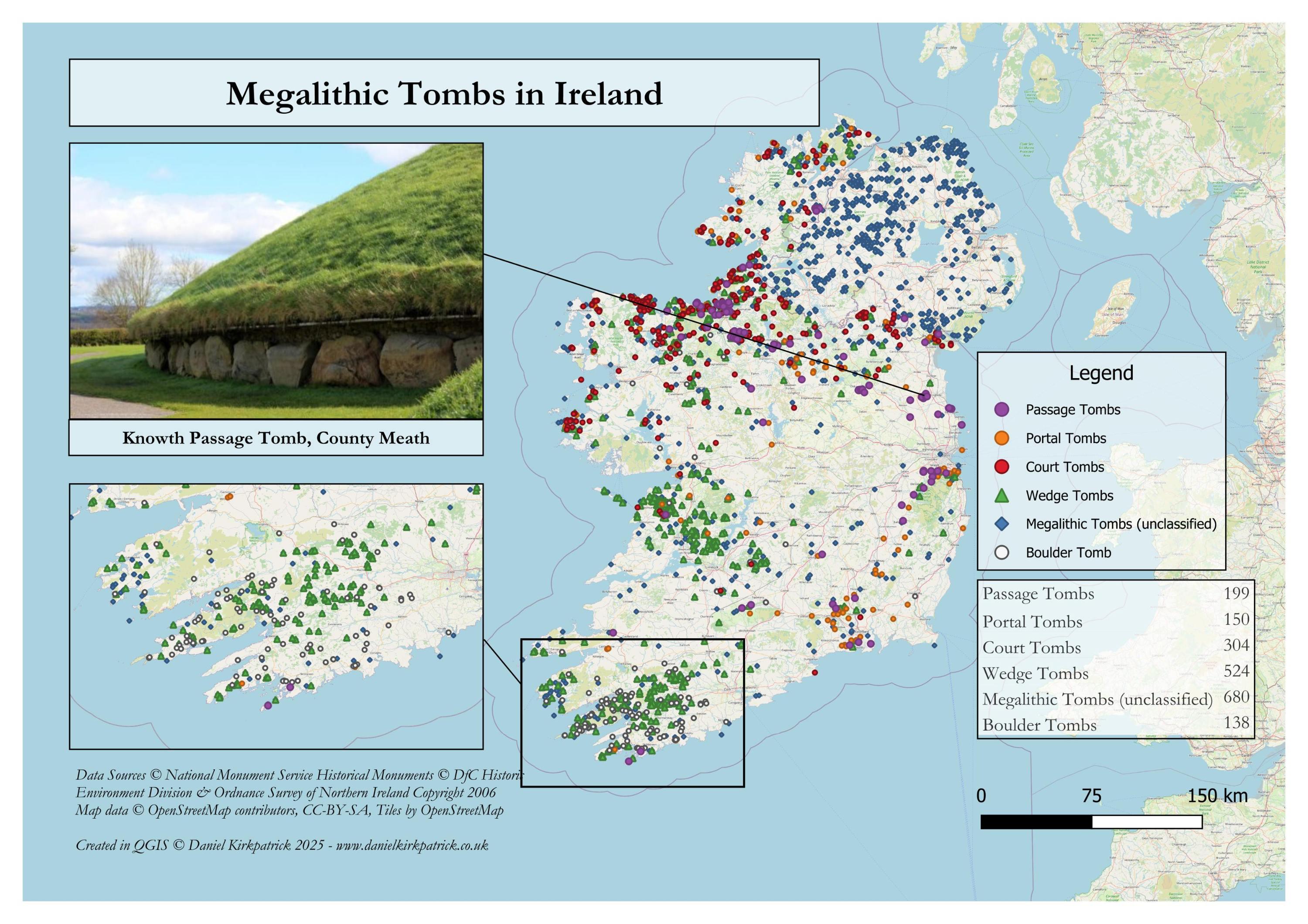
I've created an updated map showing the distribution of all recorded megalithic tombs across Ireland. Northern Ireland data doesn't provide a breakdown of types, but you can see the overall distribution.
The map is populated with a combination of National Monument Service data (Republic of Ireland) and Department for Communities data for Northern Ireland. The map was built using some PowerQuery transformations and then designed in QGIS.
I previously mapped a bunch of other ancient monument types, the latest being historical sites in North Antrim.
I've taken on helpful feedback from various comments to include an image of what the data represents alongside cleaning up some of the legend and table. So I'm slowly making these look a bit more professional. But I do appreciate the feedback, so keep it coming.
by Sarquin
2 Comments
For those who want to see the data sources check out [NMS here ](https://www.archaeology.ie/collections-and-publications/publications/monument-class-and-scope-notes/)and the [UK Open Data here](https://www.data.gov.uk/dataset/46240fa5-db15-469e-b1c8-0460504b951c/northern-ireland-sites-and-monuments-record). For the tooling, I used QGIS and PowerQuery (Excel).
You can also see my interactive map of megalithic sites with the site descriptions here too: [https://www.danielkirkpatrick.co.uk/irish-history/megalithic-map-of-ireland/](https://www.danielkirkpatrick.co.uk/irish-history/megalithic-map-of-ireland/)
Nice visualization! I’m guessing there’s some kind of data gathering in quirk in Northern Ireland that means all those tombs are unclassified?