
overpass api python script used to scrape osm data for surveillance-alpr elements and their coordinates in conus, mapped using qgis
learn more about the massive uptick in surveillance on deflock
https://deflock.me/
by geoiao
overpass api python script used to scrape osm data for surveillance-alpr elements and their coordinates in conus, mapped using qgis
learn more about the massive uptick in surveillance on deflock
https://deflock.me/
by geoiao
2 Comments
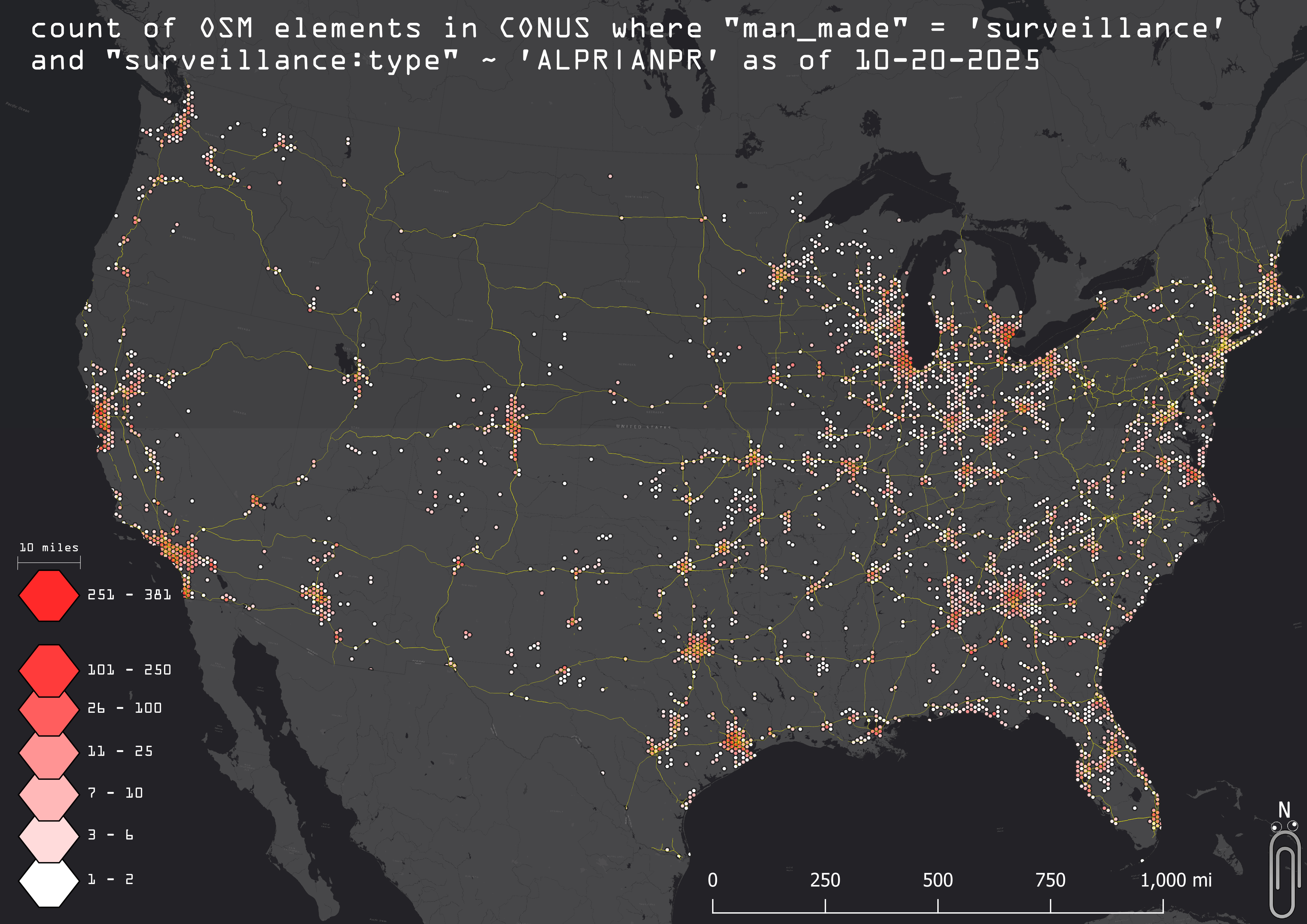
overpass api python script used to scrape osm data for surveillance-alpr elements and their coordinates in conus, mapped using QGIS
learn more about the massive uptick in surveillance on deflock
[https://deflock.me/](https://deflock.me/)
This map includes EZPass toll ALPRs… Are we considering those to be the same level of invasiveness as Flock? And if so, what is a reasonable workaround aside from returning to tollbooths?
I’m definitely anti-Flock camera, which is why I’m mentioning this. Adding necessary toll cameras to this, IMO, waters down the point.