
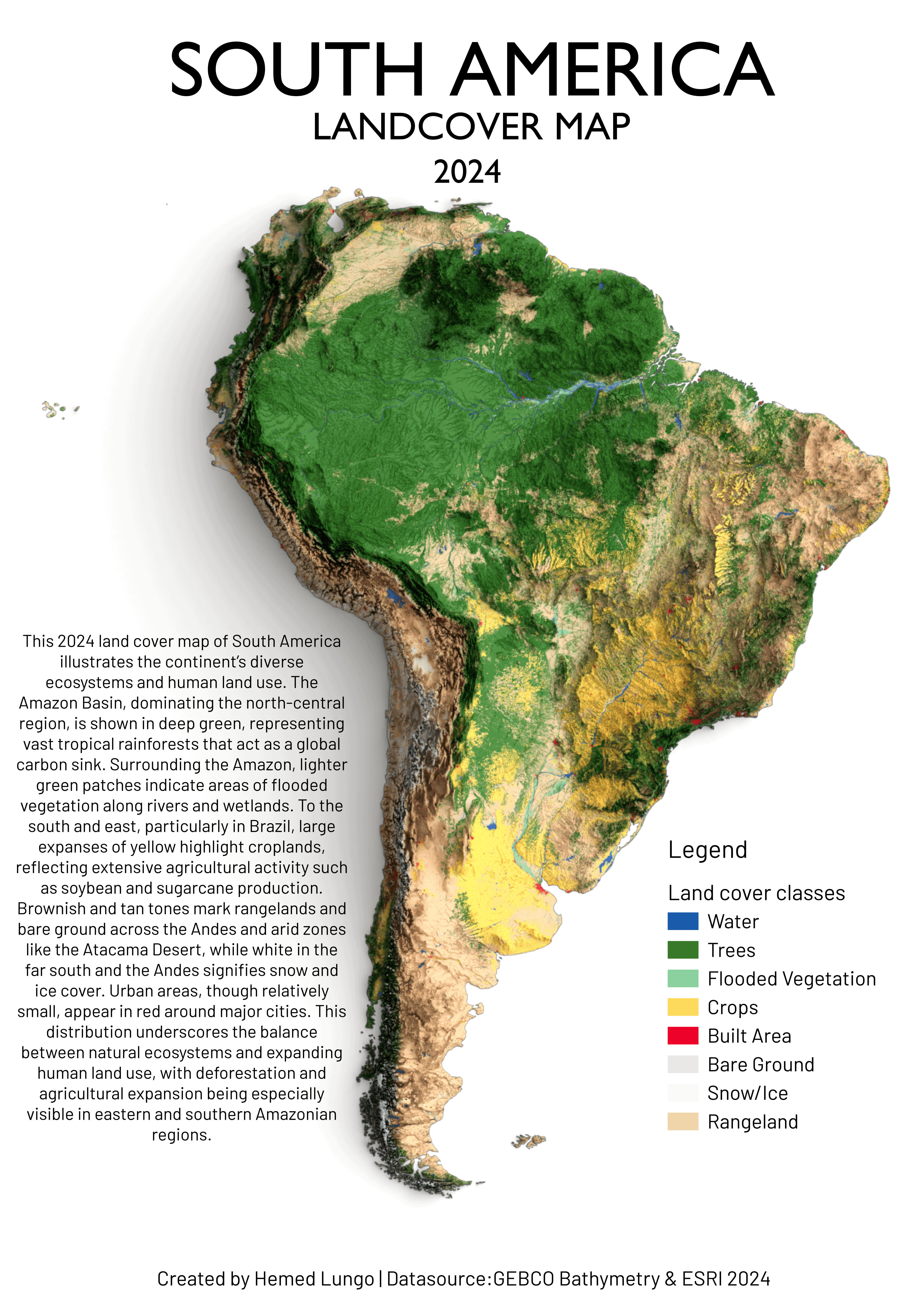
This is my original map showing the dynamic land cover of South America in 2024, created using ESRI Dynamic World 2024 and GEBCO Bathymetry data. The map highlights the vast Amazon Basin, still the largest rainforest on Earth and a critical global carbon sink, though increasingly threatened by deforestation and agricultural expansion. Across Brazil, Argentina, and beyond, croplands and rangelands are rapidly spreading to meet the demand for soybeans, sugarcane, and cattle. Wetlands such as the Pantanal, Amazon floodplains, and Orinoco Basin remain biodiversity hotspots but are under stress from droughts and land use changes. At the same time, the Atacama Desert and arid Andean regions show the dominance of bare ground, while glaciers and snowfields in the Andes and Patagonia are retreating due to warming. Megacities like São Paulo, Buenos Aires, Lima, and Bogotá continue to expand, transforming surrounding
by hemedlungo_725
3 Comments
I love these kinds of maps! Im surprised at the lack of water inland. I don’t know much about geography but given the high rainfall at certain areas I would have expected some larger lakes
It’s crazy to see most of the population especially in Brazil is concentrated in few area and the rest of the country is mostly unpopulated or sparsely populated.
“Rangeland” – it’s called grassland. Not every bit of steppe, grassland, prairie, etc. Exists as range for cattle.