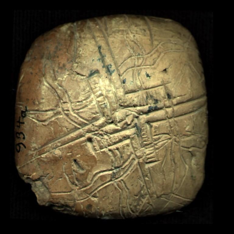
Perhaps the oldest “world map”: This small Sumerian clay tablet depicts four streams representing the Two Rivers and Upper+Lower Seas (Mediterranean + Persian Gulf) w/ plowed fields, in center the sign 𒆳 (Kur) for Enlil’s Temple at Nippur. Shuruppak (Tell Fara), ED IIIa, c. 26th cen. BCE. [769×769]