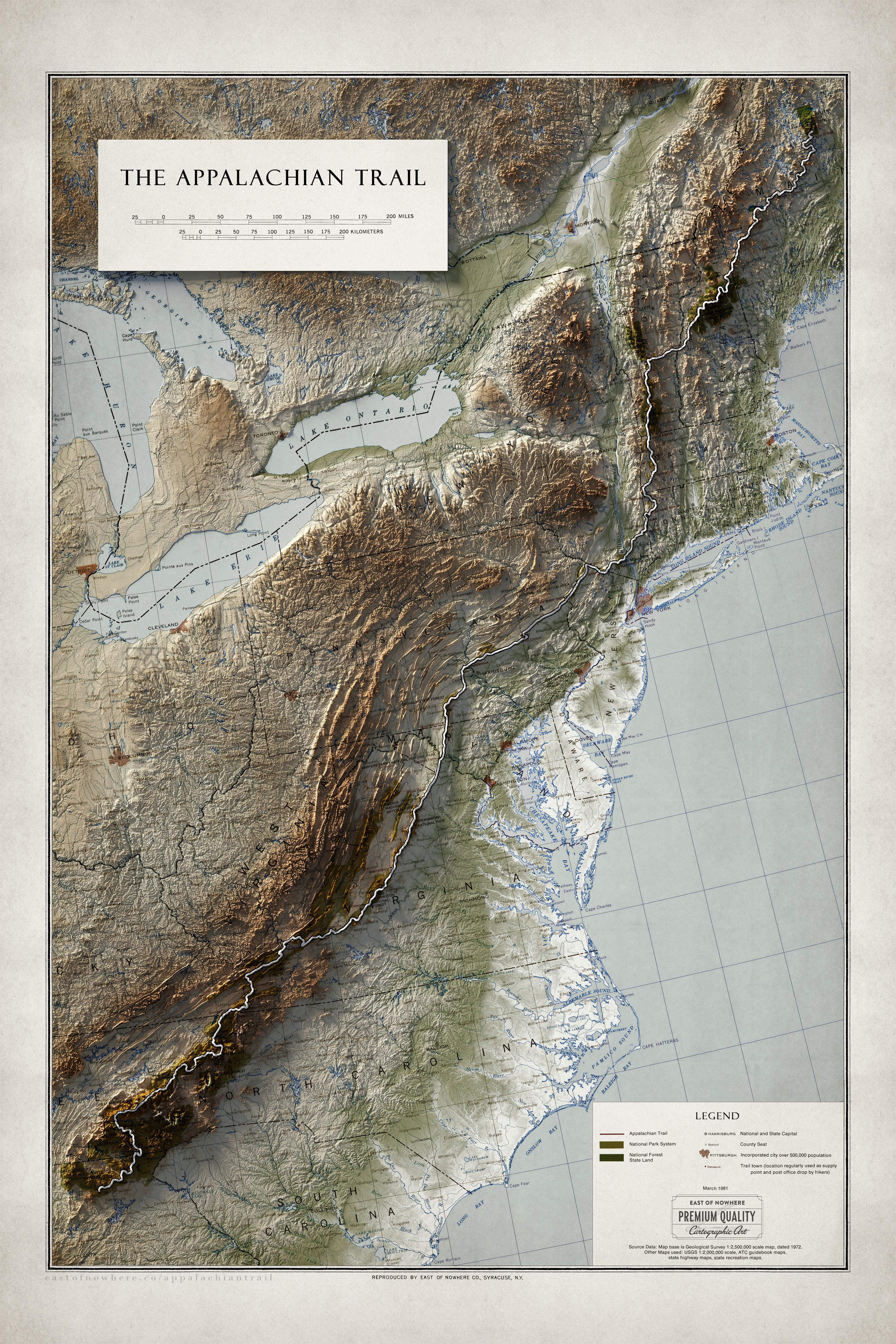
eon_james on September 11, 2023 12:32 am [Original Image Source](https://www.loc.gov/item/83694254/) [Global Elevation Dataset (GEBCO)](https://www.gebco.net/data_and_products/gridded_bathymetry_data/) Tools: QGIS, Blender This map is a blend of modern topography with antique surveys, showing the exaggerated terrain of the Appalachian Trail around the year 1981.

1 Comment
[Original Image Source](https://www.loc.gov/item/83694254/)
[Global Elevation Dataset (GEBCO)](https://www.gebco.net/data_and_products/gridded_bathymetry_data/)
Tools: QGIS, Blender
This map is a blend of modern topography with antique surveys, showing the exaggerated terrain of the Appalachian Trail around the year 1981.