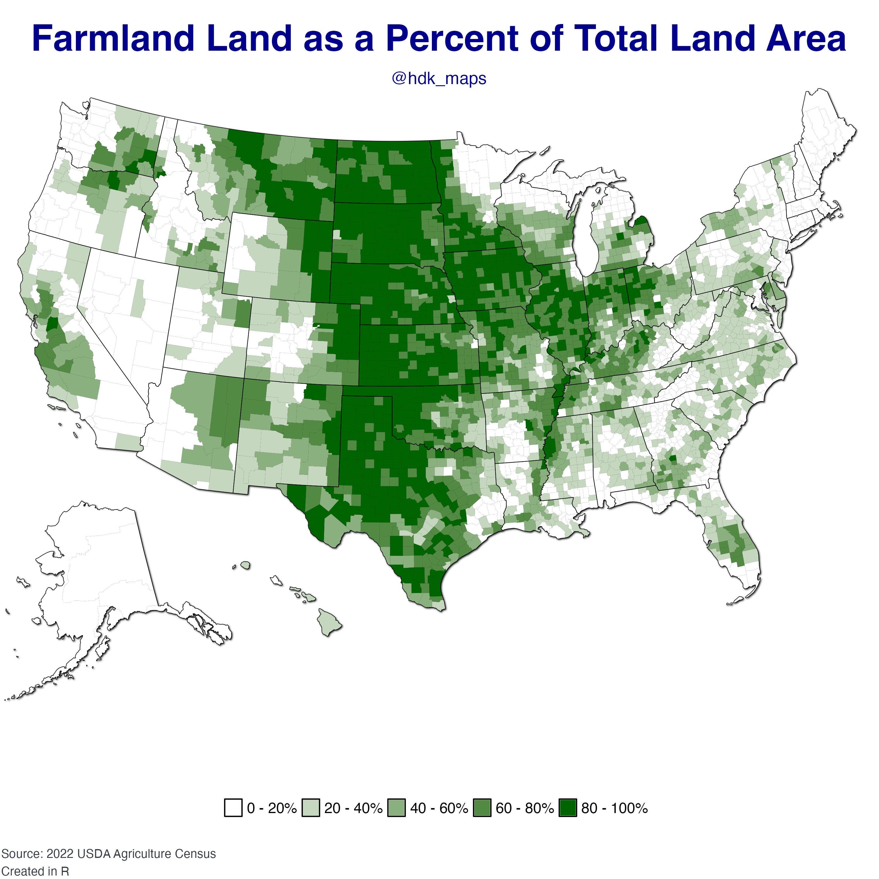
Share Facebook Twitter LinkedIn Pinterest Bluesky Threads [OC] Map of Farmland in the US by haydendking
haydendking on February 4, 2025 2:05 pm Data: [https://quickstats.nass.usda.gov/#192AC790-6279-32C2-9483-94F716CC6D81](https://quickstats.nass.usda.gov/#192AC790-6279-32C2-9483-94F716CC6D81) Tools: R – packages: ggplot2, dplyr, stringr, sf, usmap, ggfx, scales Reposted with better contrast
ZipTheZipper on February 4, 2025 2:13 pm I think it would he interesting to see that differentiated between crop land and grazing land.
SparrowBirch on February 4, 2025 2:15 pm I recently flew from Denver to Louisville. Looking out the window it seemed like never ending farmland.

6 Comments
Data: [https://quickstats.nass.usda.gov/#192AC790-6279-32C2-9483-94F716CC6D81](https://quickstats.nass.usda.gov/#192AC790-6279-32C2-9483-94F716CC6D81)
Tools: R – packages: ggplot2, dplyr, stringr, sf, usmap, ggfx, scales
Reposted with better contrast
Right there in the center column
I think it would he interesting to see that differentiated between crop land and grazing land.
New England: “we do not sew!”
I recently flew from Denver to Louisville. Looking out the window it seemed like never ending farmland.
Now post a map of all the farmland the ccp own