
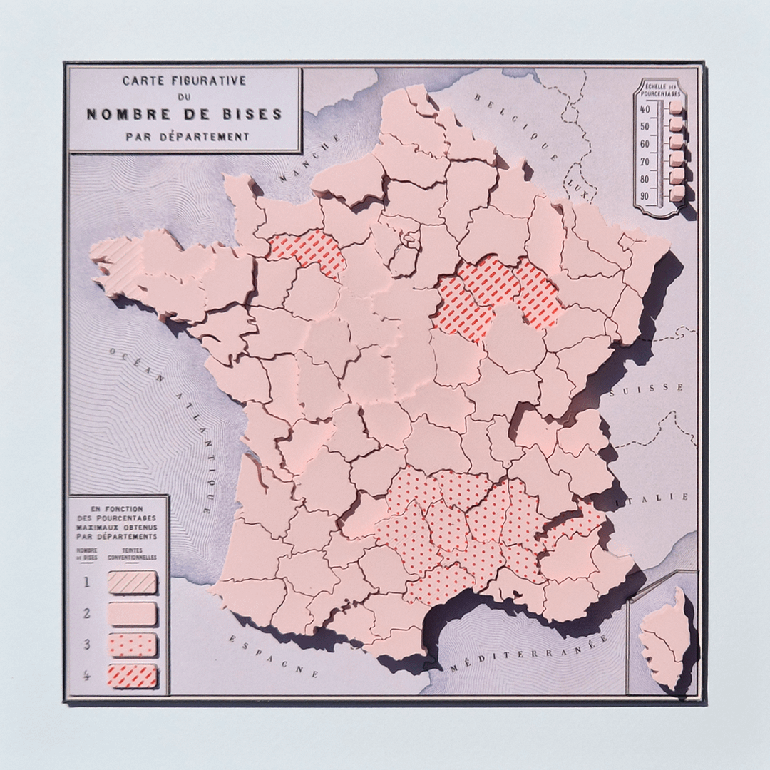
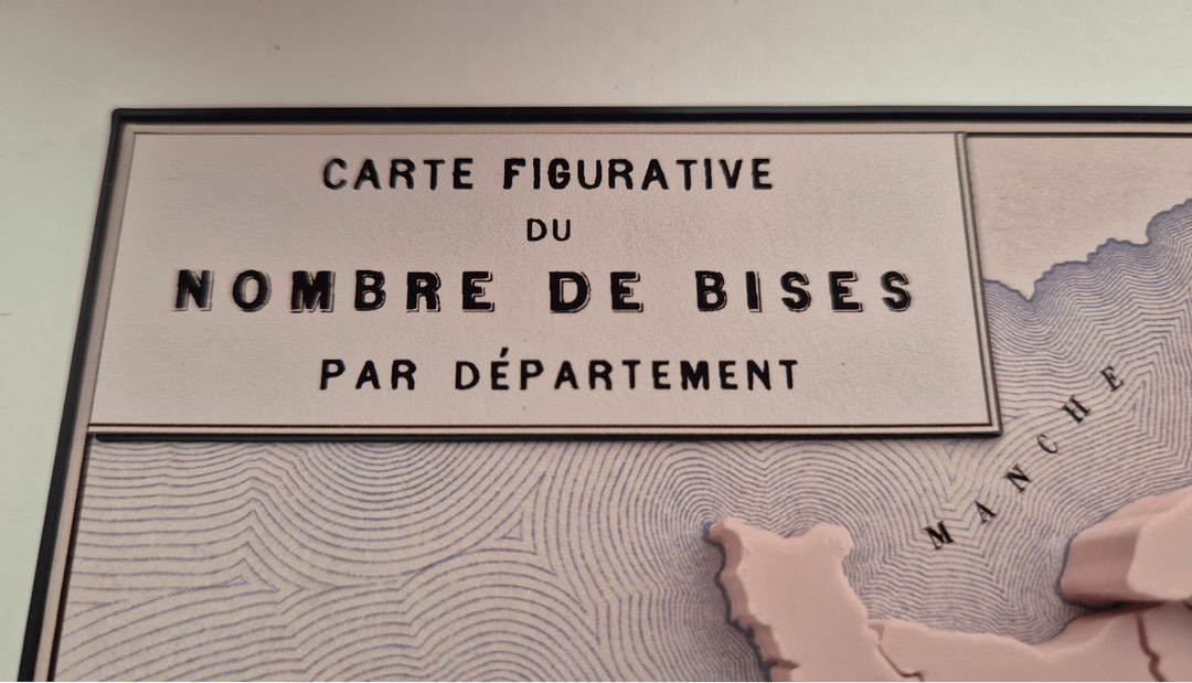
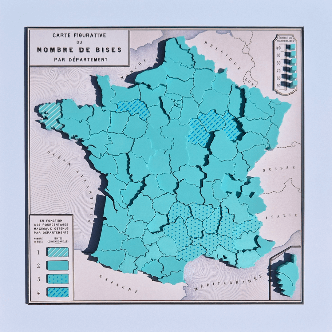
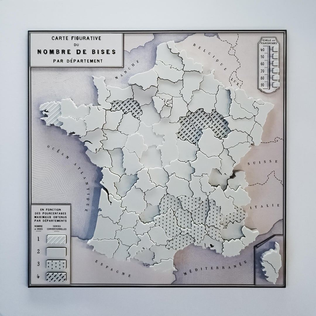
The surface colour/texture denotes the number of kisses bestowed by a plurality of residents in each department—from one to four—and the height is the percentage of that plurality. Modelled in TinkerCad, printed on an A1, data from http://combiendebises.free.fr/
The plurality approach, while not ideal from a data comprehension point of view, was the best way I could think of to have variable heights for each department. The range of the data is from 39% to 93%, and I've assigned 1mm for each 10%.
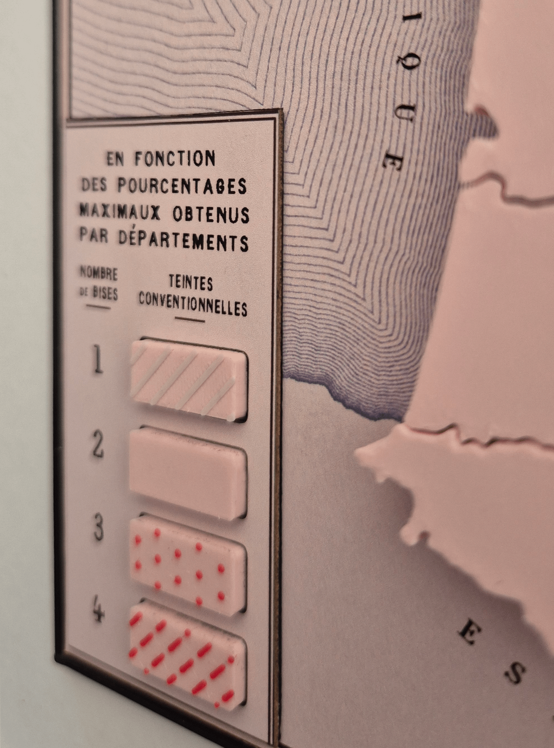
There's also a bit of compromise on data comprehension regarding the one-kiss department in the north-west (Finistère). It's quite hard to distinguish it from two-kiss departments, in photographs at least, but because I wanted to make these maps in different colours, I knew it was unrealistic to have a light main colour and an even lighter colour just for Finistère because PLA (the 3D filament) doesn't come in that many colours. Also, adding textures with a 3D printer is tricky as you kind of need them all to be on the same layer so I needed a single textureless "base colour"—pink in the main photo—for the many two-kiss depts and I thought it reasonable that more kisses should have more colour/texture. So, three kisses have the red dots (a bit more colour than just pink) and four kisses have the red dashes (even more colour). That left me needing to find some other way of "lightening" the only one-kiss department. I went with white stripes, which are intended to lighten the pink, but I'm not sure it totally works—all feedback welcome.
by AlexS-B