
I made a tool to replace the federal fire research gap. It is an extra credit project for school, would appreciate any feedback! I've made it live at: https://pnw-firemap.org/
Consequently I did not read the rules and I apologize and have been permanently banned from posting. The sources are available however I am having difficulty setting up a page that allows users to download the information (I am not good at web design); I’d like for everything to be available for review.
Additionally, there is some information missing at this time that I have been unable to add due to ram limits on my laptop; I will update this in a change log with my known limitations and items.
by Latenightson4th
2 Comments
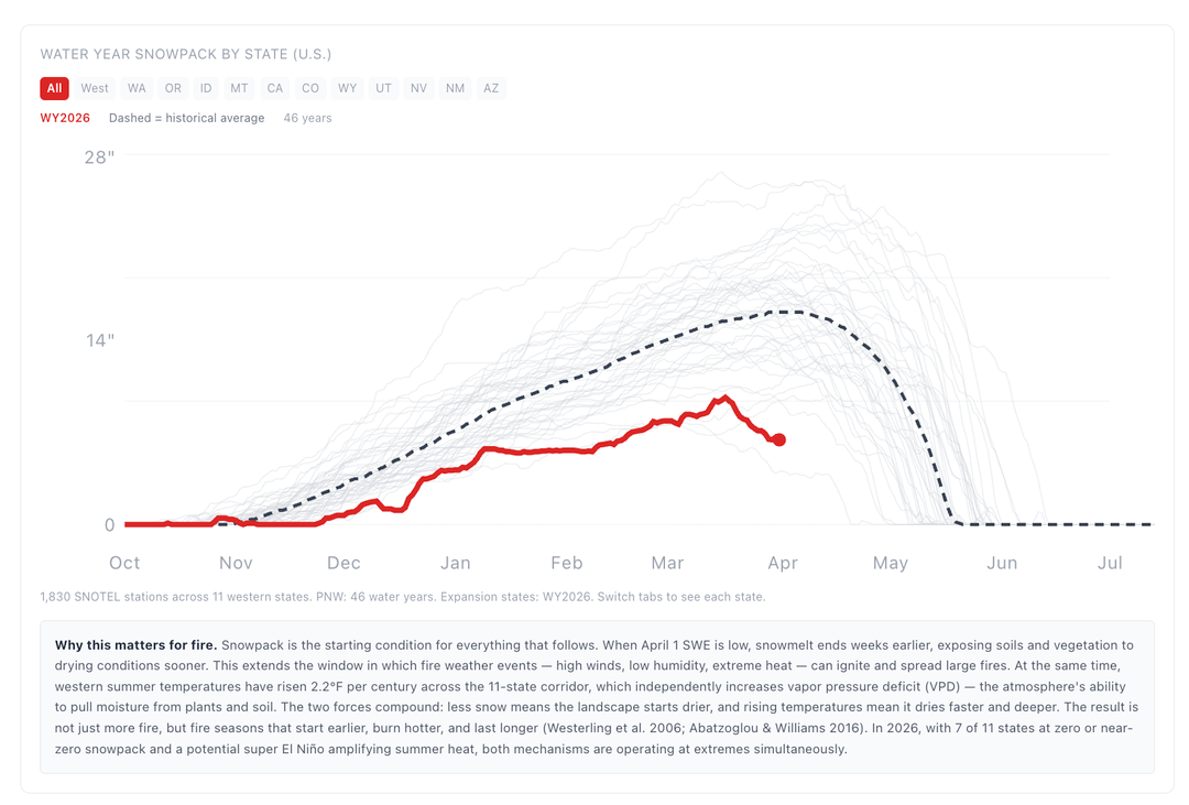
This is great. The snowpack figure is helpful, especially given how much more difficult it is to access from the USDA now. I’d love it if we could narrow by basin instead of only state.
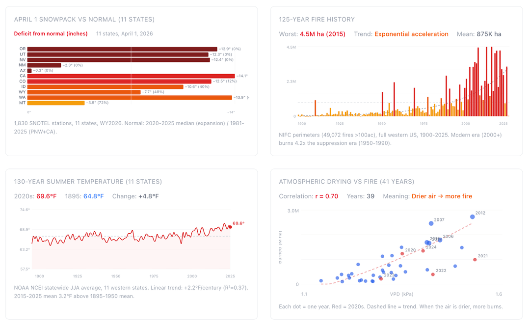
Where are the fire perimeters coming from? There are a bunch missing – does this not display complexes? For example, the 2022/2023 SFR Lightning Complex Fires (40,000 acres an 50,000 acres) are not in the perimeter history.
Who is the intended audience for this? There is some editorializing that seems like this might be intended to communicate with policymakers, but you also say it can be used for resource pre-positioning or treatment prioritization (which would suggest land management agencies are the target). As a data person, it is frustrating to not see any sources for data.. I also see the word ‘research’ in a lot of places, but it seems clear that this is just digesting other publicly available data sources, right?
You could look at the NIFC 7-day and monthly “significant fire potential” outlooks for some additional components to include in your model (e.g., weather).