
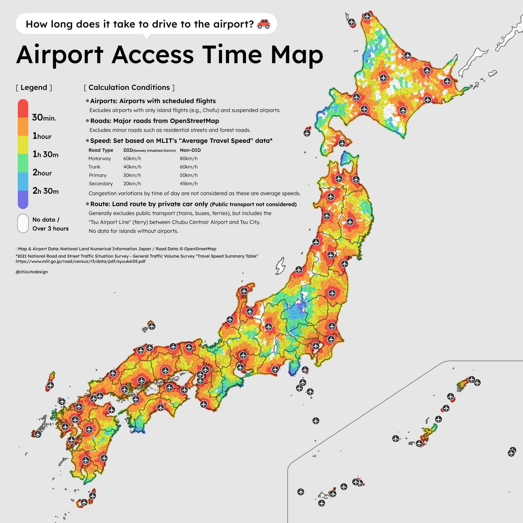
Data sources: National Land Numerical Information (MLIT Japan) for airport locations and map data; OpenStreetMap for road network; MLIT "Average Travel Speed" survey data for speed assumptions by road type.
Tools: QGIS for spatial analysis and visualization, Adobe Illustrator for layout and design.
Japan has about 100 airports with scheduled flights. I calculated the drive time from every point in the country to the nearest airport using average travel speeds that vary by road type and urban/rural area (e.g., 60 km/h on motorways in urban areas, 80 km/h in rural). The country was split into 15 regional blocks for processing.
Some things that stand out: Hokkaido (the northern island) has large gaps despite having many airports — it's just that big. Meanwhile, most of the Tokyo–Osaka corridor is within 1 hour of an airport.
by chizutodesign
2 Comments
Is this commonly done? I’d have thought there are so many trains that people wouldn’t even consider this. Never been though, so I could be totally wrong lol
I hate how colors are inverted here.