
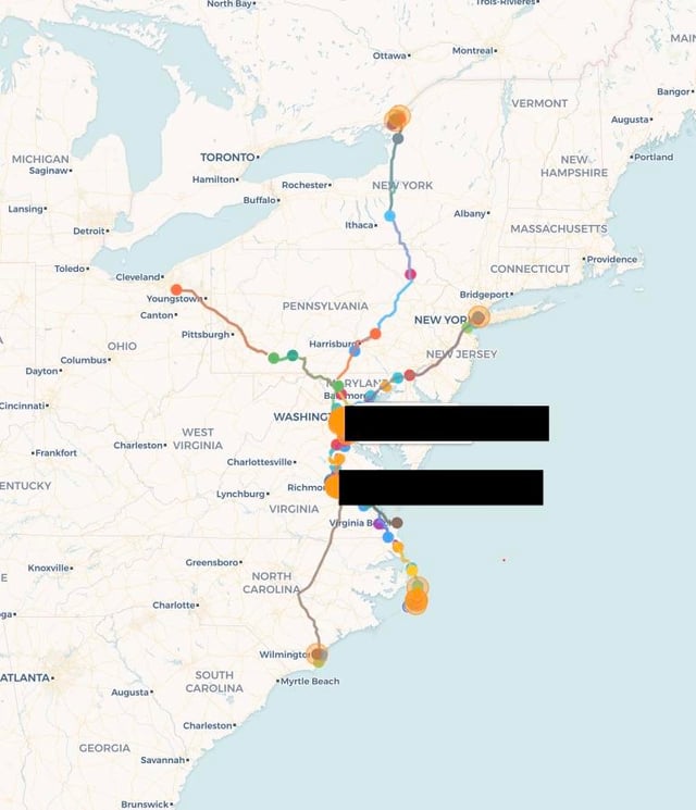
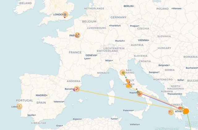
I’ve been collecting my personal location data with a custom script I wrote that hooks into iCloud and handles/saves my information. It is down to a minute-by-minute basis (in reality it’s dynamically polling based on my speed, battery, etc…).
I have started experimenting with ways to track and categorize my movements. I’ve been working with determining trips, dwell locations, and routines. I’ve put together a rudimentary prediction engine that looks at my past trips given a certain sliding window and tries to predict where I’ll be going. It’s neat stuff! My goal is to eventually get it to be super accurate, like arbitrary location (not discovered dwell locations) predictions – and tie that into my traffic camera recording program. <- super neat btw, it looks at my current position and starts recording on traffic cameras as I drive by.
But I wanted to ask all you passionate data scientists if you had any ideas or insight on how to best wrangle this sheer amount of data. I provided some pics just to show I’m not fooling around – but I also don’t want to super dox myself, haha.
Here is what I collect:
– Timestamp
– Coordinates
– Battery level
– Position type (WiFi, GPS, Cell, Pipeline)
– Low power mode
– Polling interval
Here is what I derive:
– Time zone
– Speed
– Course/Bearing
– Distance delta
– Battery discharge/charge rate
– Historical cluster center & my distance from it
Any insight would be greatly appreciated. I’m going to cross post on r/GIS too – hopefully someone’s as jazzed about the data as I am.
by Voyager_Ten
3 Comments
Can you share your code and how to connect it to iCloud? I’ve always had location history on Google Maps and used a program to make heatmaps, but it seems that last year it changed from all actual locations to ‘journeys’ with much less granular/precise data.
For more touristy outings, add in photos that you take and the metadata from them so you can show a map of where you went, and then pop up the photos you took at each place.
Or create a commuting “game” where you show your current location compared to your average location during your commute to work, kind of like Mario kart when you race against the ghost on time trials.
Try to identify predictors of where you will go on a particular day, and see how accurate you can train it to be, update the predictions every X minutes based on the latest data. I’m thinking neural network type setup.
Create a “how close was I to…” log, which pulls police data and shows you how close you were to a robbery, murder, car crash etc on any given day. Replay it as a video showing your movements through the city with nearby incidents showing up as flashes of light on the map. Maybe post-process it for “this day 12 months ago” to allow for lag in police reporting.
Use your traffic camera data to run license plates and see if you can identify other vehicles which you repeatedly cross paths with whilst driving to work without realising. Then add LPR to a camera in your car which will automatically tell you if you “know” another car in realtime.
One person’s data is worthless. One million people’s data is worth a lot.