
It's cherry blossom season y'all! Time to go touch some grass and go see some blossoms.
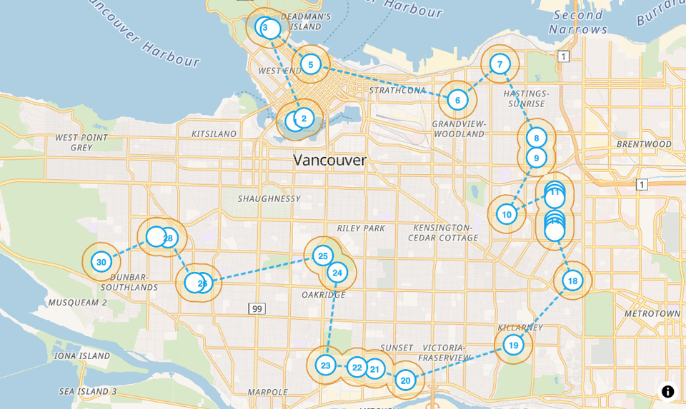
I used the trees and streets data from the Vancouver Open Data portal and mapped out the top 10 and 30 densest cherry blossom trees in Vancouver and mapped it out for folks to visit (walk? run? bike?). I'm hoping to bet on some of my data science skills and confirm the locations on a run some time this week.
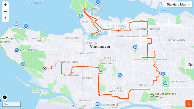
I tried to go through and map out on my own a traveling salesman path, but the road data might be a bit weird and it wasn't pathing right for me, so I took the points and passed it through to OSRM (https://project-osrm.org/) to make GPX files that I loaded into Straval
I started writing about the process here: https://chendaniely.github.io/posts/2026/2026-03-30-yvr-cherry-blossoms-marathon/ Just the first set of results for now, i'll make a separate post about the technical bits behind the scenes later this week.
The post has links to gpx files, strata, and google maps pins.
If you're in East Van, you seem to be by the best streets in the city?
(currently doing a complete website/blog overhaul so it's only this post for now)
by chendaniely