
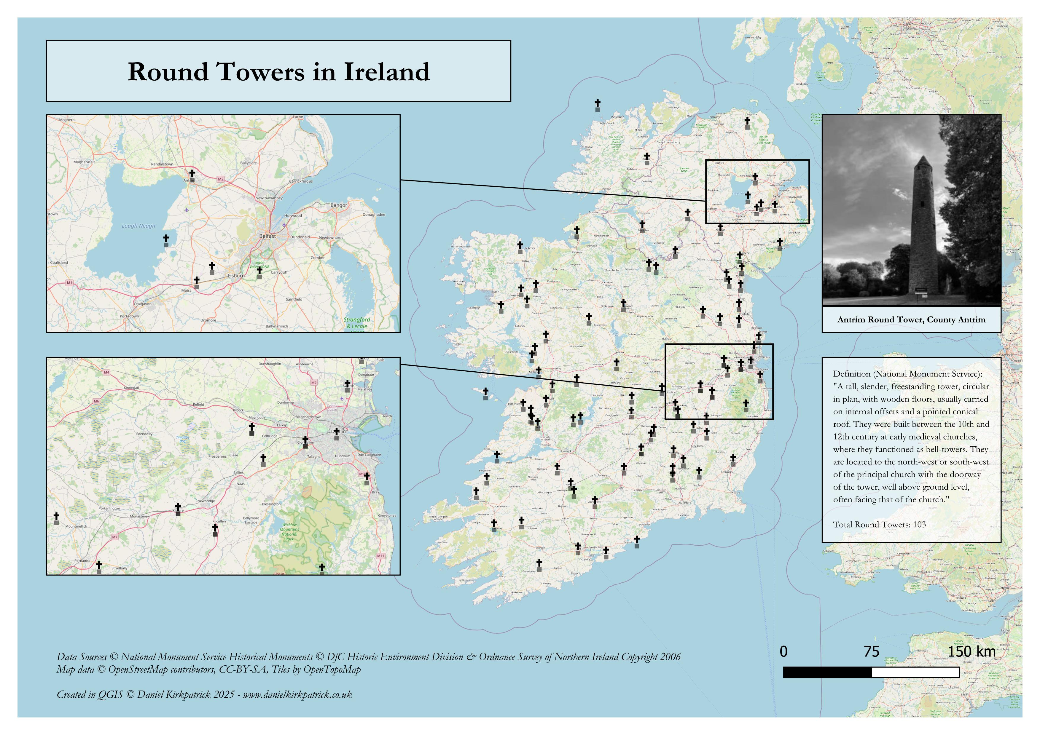
I’ve created this map showing the location of all recorded round towers across the whole of Ireland. The map is populated with a combination of National Monument Service data (Republic of Ireland) and Department for Communities data for Northern Ireland.
Most of these sites are located alongside abbeys and/or other larger monastic sites, though often the tower stack is all that remains.
I previously mapped a load of other ancient monument types, the latest being scheduled monuments across the UK.
by Sarquin
1 Comment
If you’re interested in my research on one of the most iconic round towers in Northern Ireland, Antrim, you can read about it here: [https://www.danielkirkpatrick.co.uk/historical-sites/antrim-round-tower/](https://www.danielkirkpatrick.co.uk/historical-sites/antrim-round-tower/)
For those who want to see the data sources check out [NMS here, ](https://www.archaeology.ie/collections-and-publications/publications/monument-class-and-scope-notes/)and the [UK Open Data here](https://www.data.gov.uk/dataset/46240fa5-db15-469e-b1c8-0460504b951c/northern-ireland-sites-and-monuments-record). For the tooling, I used QGIS and PowerQuery (Excel).