
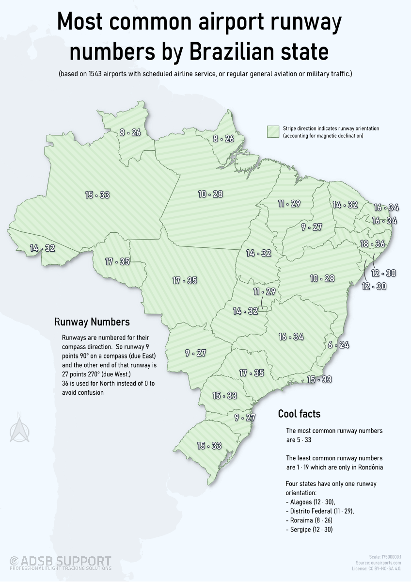
This is the second visualization of this type I've done, that this time looks at all the major airport runways in Brazil, and shows the most common orientation in each state.
I learned from my first post and have hopefully included all the great feedback there into this one. In addition, I decided to change the land colour to green to better reflect the Brazilian national colours, and to give more contrast to the background. I also included a shadow of the continent to help with context.
I'm not completely happy with the text placement, but this was the least worst.
As with last time, your constructive feedback is encouraged!
I used runway data from ourairports.com, manipulated it in LibreOffice Calc, and mapped it in QGIS 3.44
by ADSBSGM
2 Comments
Runway data is from ourairports.com, then manipulated it in LibreOffice Calc, and mapped in QGIS 3.44
Beautiful but absolutely useless data. Perfect.