
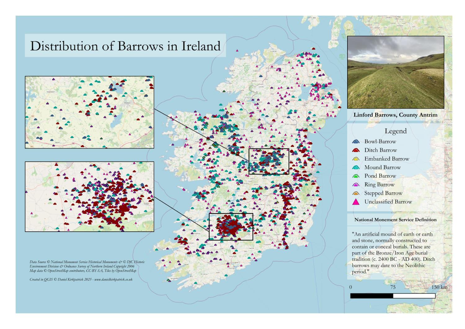
I’ve created this map showing the location of all recorded barrows across the whole of Ireland. The map is populated with a combination of National Monument Service data (Republic of Ireland) and Department for Communities data for Northern Ireland.
While you can clearly see barrows all over the island, the greatest concentration is overwhelmingly in the west of Tipperary. I learned (from an Ulster Archaeological Society lecture just this week!) that this was likely the centre of regional power in early Iron Age Muma (modern-day Munster) rather than Cashel, and would have likely been a key regional site in the Bronze Age. For me, this makes sense given most of these sites date to the Bronze Age (2,400-400BC). Though I find their sheer number (around 3,000) still pretty staggering. I am not an expert, however, so welcome any other views which will likely be much better informed than my own.
I previously mapped a load of other ancient monument types, the latest being ringfort locations in Ireland.
This is the static version of the map, but I’ve also created an interactive map which I’ve linked in the comment below for those interested in more detail and analysis (the interactive map also includes barrow locations). You can use it to filter the types of barrows and select for more background detail on each site.
by Sarquin
1 Comment
You can see the interactive map of barrow locations along with a more detailed overview of their classification here: [https://www.danielkirkpatrick.co.uk/irish-history/irish-barrows-map/](https://www.danielkirkpatrick.co.uk/irish-history/irish-barrows-map/)
For those who want to see the data sources check out [NMS here, ](https://www.archaeology.ie/collections-and-publications/publications/monument-class-and-scope-notes/)and the [UK Open Data here](https://www.data.gov.uk/dataset/46240fa5-db15-469e-b1c8-0460504b951c/northern-ireland-sites-and-monuments-record). For the tooling, I used QGIS and PowerQuery (Excel). The online interactive map was made in ArcGIS with initial data cleansing in QGIS.