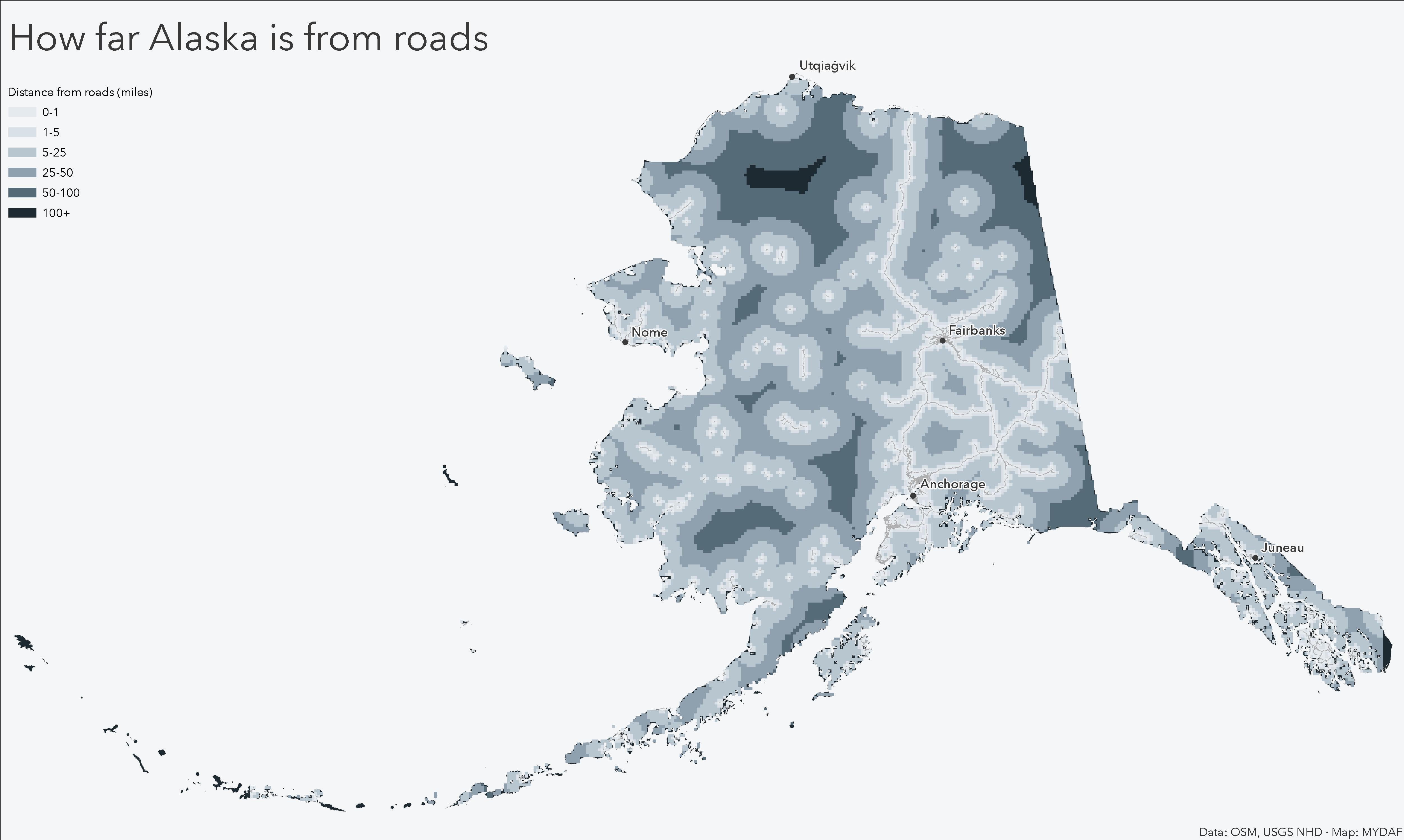
Each pixel shows the distance to the nearest mapped road in Alaska.
Calculated using road centerlines and Euclidean distance to highlight how much of the state lies far from road access.
**[OC]**
Data source: OpenStreetMap road centerlines
Method: Distance Accumulation (Euclidean distance)
Tools: ArcGIS Pro
GreenFox1505 on
What are the islands? What kind of road isn’t connected to the rest of the road network? Are they places with roads that are only reachable by airplane?
Cityplanner1 on
Ain’t no roads where we’re going…
Diligent-Chance8044 on
You know what this tells me. If you want to find a rare species or plant check those areas.
Fmcdh on
What’s the name of the dark place? I need to live there physically instead of just mentally.
gratiaetfides on
Shouldn’t all the white spots be connected (by roads)?
Markjv81 on
Where we’re going we don’t need roads
Bucksin06 on
There’s only one road in the northern half of the state the Dalton highway

8 Comments
**[OC]**
Data source: OpenStreetMap road centerlines
Method: Distance Accumulation (Euclidean distance)
Tools: ArcGIS Pro
What are the islands? What kind of road isn’t connected to the rest of the road network? Are they places with roads that are only reachable by airplane?
Ain’t no roads where we’re going…
You know what this tells me. If you want to find a rare species or plant check those areas.
What’s the name of the dark place? I need to live there physically instead of just mentally.
Shouldn’t all the white spots be connected (by roads)?
Where we’re going we don’t need roads
There’s only one road in the northern half of the state the Dalton highway