
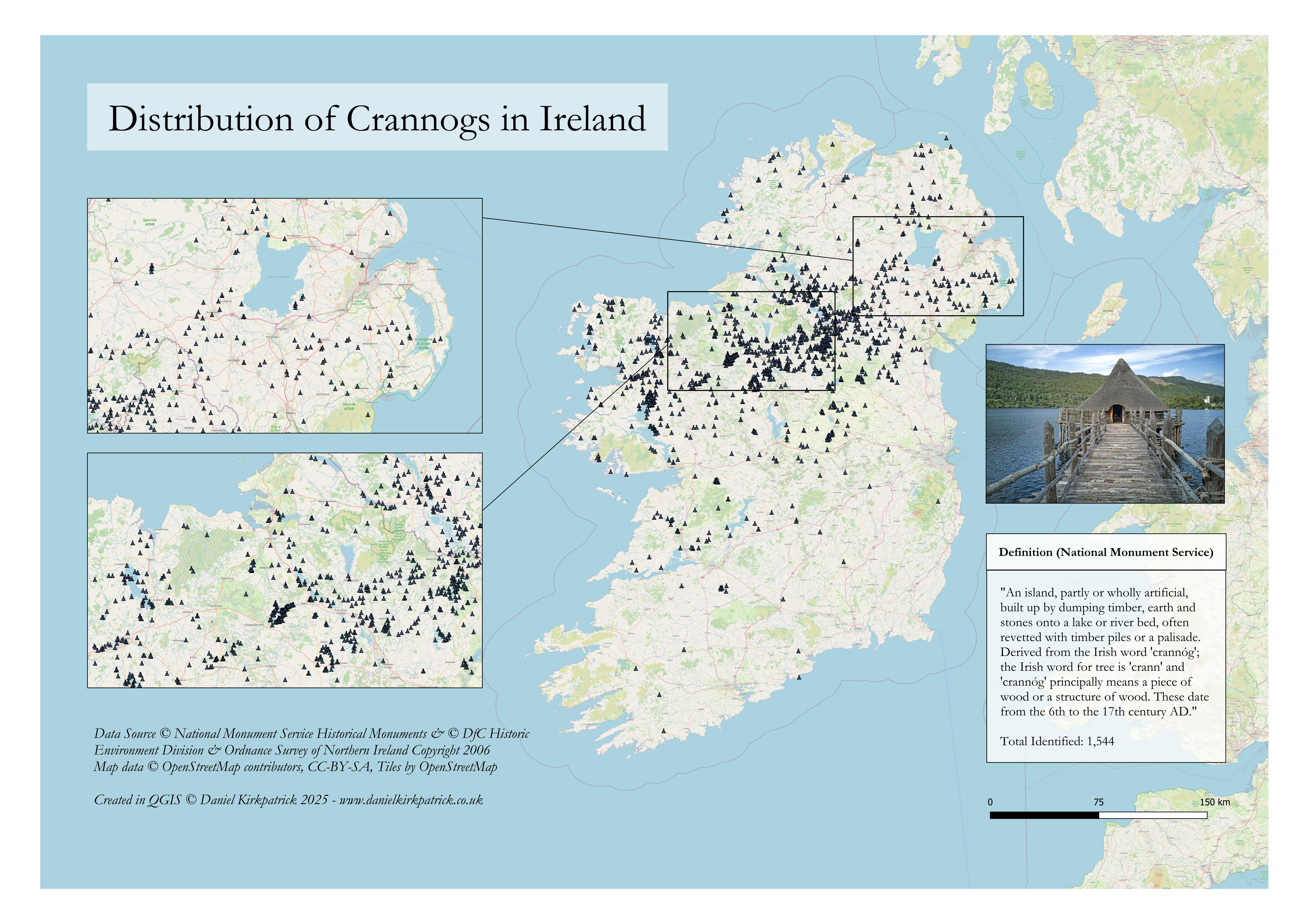
I’ve created this map showing the location of all recorded crannogs across the whole of Ireland. The map is populated with a combination of National Monument Service data (Republic of Ireland) and Department for Communities data for Northern Ireland.
For those unfamiliar with crannogs, they are essentially ringforts on water. More technically, they were early medieval water-based settlements often built on artificial islands.
And as a random bit of trivia, I also just learned that the monkey enclosure at Belfast Zoo used to be a crannog.
I previously mapped a bunch of other ancient monument types, the latest being hillfort locations across Ireland.
This is the static version of the map, but I’ve also created an interactive map which I’ve linked in the comment below for those interested in more detail and analysis (the interactive map also includes ringfort locations).
by Sarquin
4 Comments
You can see the interactive map of crannog locations along with a more detailed overview of their function here: [https://www.danielkirkpatrick.co.uk/irish-history/iron-age-buildings-ireland/](https://www.danielkirkpatrick.co.uk/irish-history/iron-age-buildings-ireland/)
For those who want to see the data sources check out [NMS here, ](https://www.archaeology.ie/collections-and-publications/publications/monument-class-and-scope-notes/)and the [UK Open Data here](https://www.data.gov.uk/dataset/46240fa5-db15-469e-b1c8-0460504b951c/northern-ireland-sites-and-monuments-record). For the tooling, I used QGIS and PowerQuery (Excel).
great work! do you have github?
‘Please do not feed the crannogs’
Thanks for all the maps you create. They are inspiring me to go out and visit some of them sites near me in the Midlands.