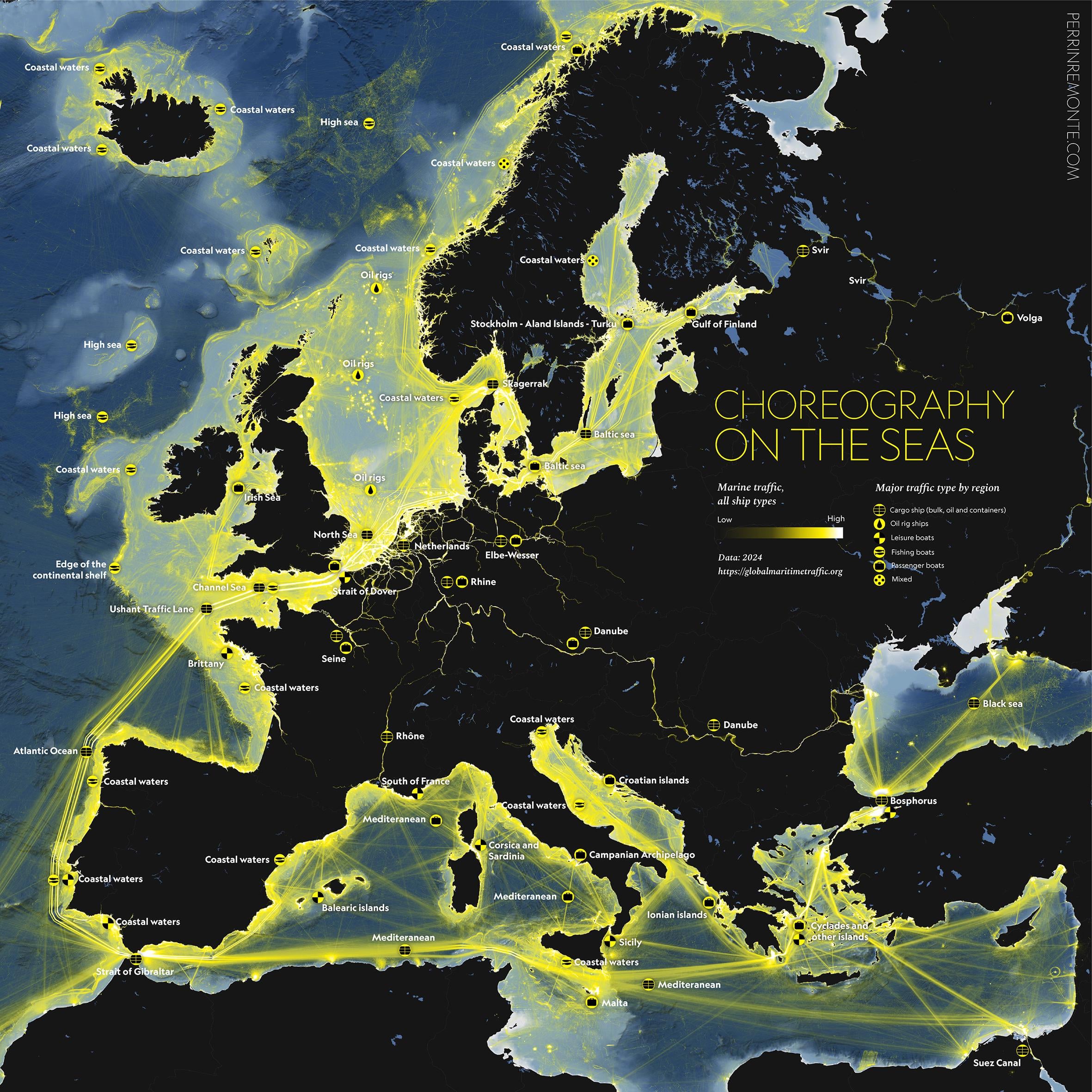
Hi r/DataIsBeautiful, I am a cartographer and recently got my hands on the awesome data from [GMTDS](https://globalmaritimetraffic.org/gmtds.html) and could create a visualisation of the average traffic (all ship types combined) in Europe in 2024. I tried to show what was the major type of traffic by area with some icons. I used QGIS to process the data and Adobe Illustrator for the graphic design

1 Comment
Hi r/DataIsBeautiful, I am a cartographer and recently got my hands on the awesome data from [GMTDS](https://globalmaritimetraffic.org/gmtds.html) and could create a visualisation of the average traffic (all ship types combined) in Europe in 2024. I tried to show what was the major type of traffic by area with some icons. I used QGIS to process the data and Adobe Illustrator for the graphic design
You’ll find mire similar maps [here](https://www.perrinremonte.com/thema-eng), on my website! (I recommend browsing the website on a laptop screen)