
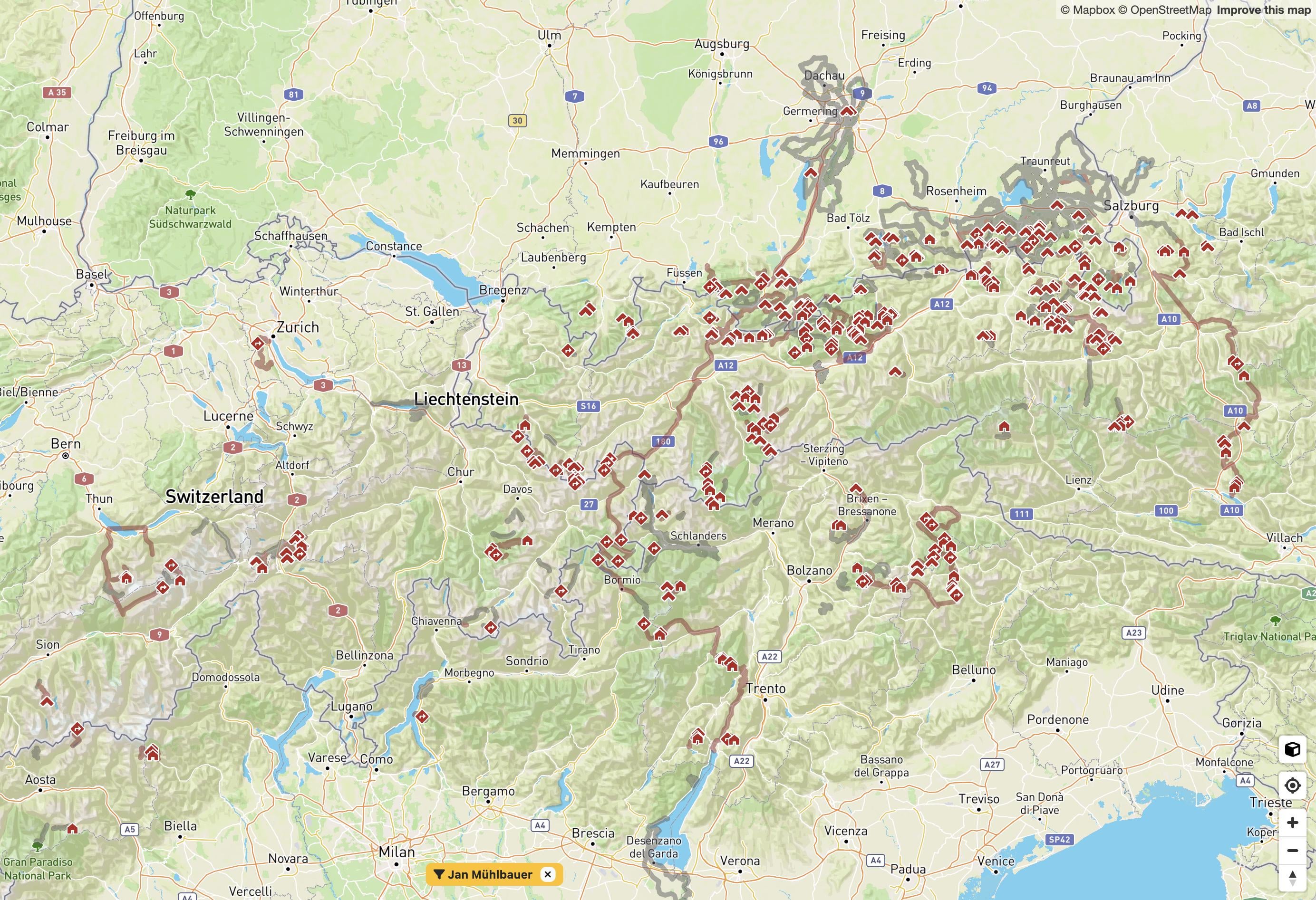
For a decade I have been tracking my mountain adventures year-round using a gps watch, mostly a Garmin Forerunner.
I combined this GPS data with openstreetmap features to identify which summits, passes, and huts I’ve reached in the Alps. Guess my upcoming travels will have to clear the white spots…
I built a tool for analysing my activity history, which I used to generate this map (peakproject.de).
by JanM5050