
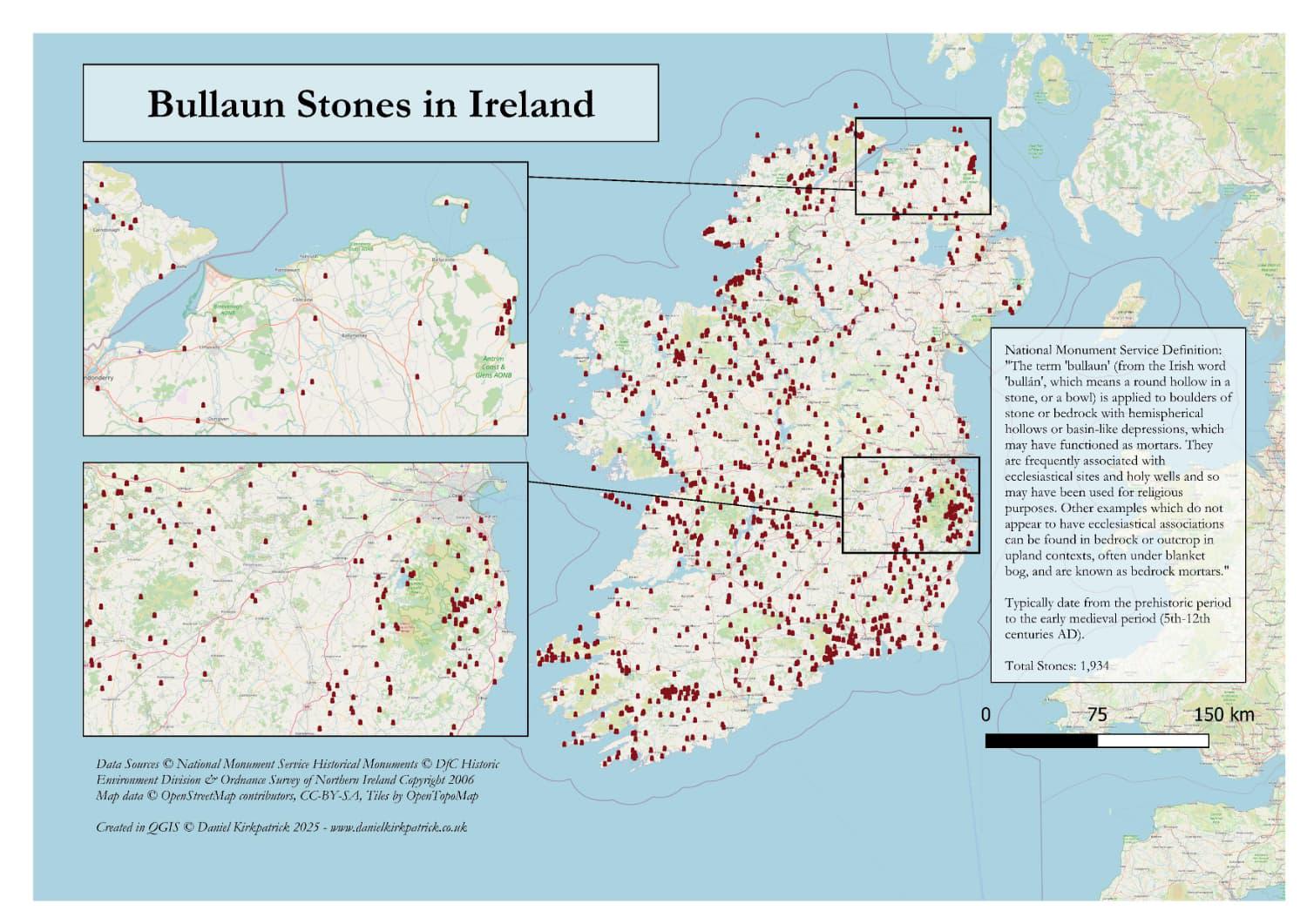
Here are all recorded bullaun stone locations across the whole of Ireland. The map is populated with a combination of National Monument Service data (Republic of Ireland) and Department for Communities data for Northern Ireland. The map was built using some PowerQuery transformations and then designed in QGIS.
The data for Northern Ireland required a bit of filtering so might be a little off. Welcome thoughts on whether there's anything that is missing or looks a bit off.
For those – like me initially – who don't know what a bullaun stone is, the map includes this definition from the National Monument Service which I found helpful: "The term 'bullaun' (from the Irish word 'bullán', which means a round hollow in a stone, or a bowl) is applied to boulders of stone or bedrock with hemispherical hollows or basin-like depressions, which may have functioned as mortars. They are frequently associated with ecclesiastical sites and holy wells and so may have been used for religious purposes. Other examples which do not appear to have ecclesiastical associations can be found in bedrock or outcrop in upland contexts, often under blanket bog, and are known as bedrock mortars."
For those wanting to interpret this, there's a few key points. Firstly these should reflect medieval settlement patterns in Ireland. The concentrations in the South East and North East would reflect this I'd argue. They are also closely linked to early Christian sites, so again speak to where Christianity may have developed earliest. Data quality in Northern Ireland is quite poor for this, so I don't think that's reflected here. But perhaps some truth to this in the rest of Ireland. These are my basic interpretations, so welcome other views.
I previously mapped a bunch of other ancient monument types, the latest being standing stones across Ireland
Any thoughts about the map or insights would be very welcome.
by Sarquin
1 Comment
For those who want to see the data sources check out [NMS here ](https://www.archaeology.ie/collections-and-publications/publications/monument-class-and-scope-notes/)and the [UK Open Data here](https://www.data.gov.uk/dataset/46240fa5-db15-469e-b1c8-0460504b951c/northern-ireland-sites-and-monuments-record). For the tooling, I used QGIS and PowerQuery (Excel).
If interested, I have recently researched some of the sites where these stones have been found, like Antrim Round Tower: [https://www.danielkirkpatrick.co.uk/historical-sites/antrim-round-tower/](https://www.danielkirkpatrick.co.uk/historical-sites/antrim-round-tower/)