
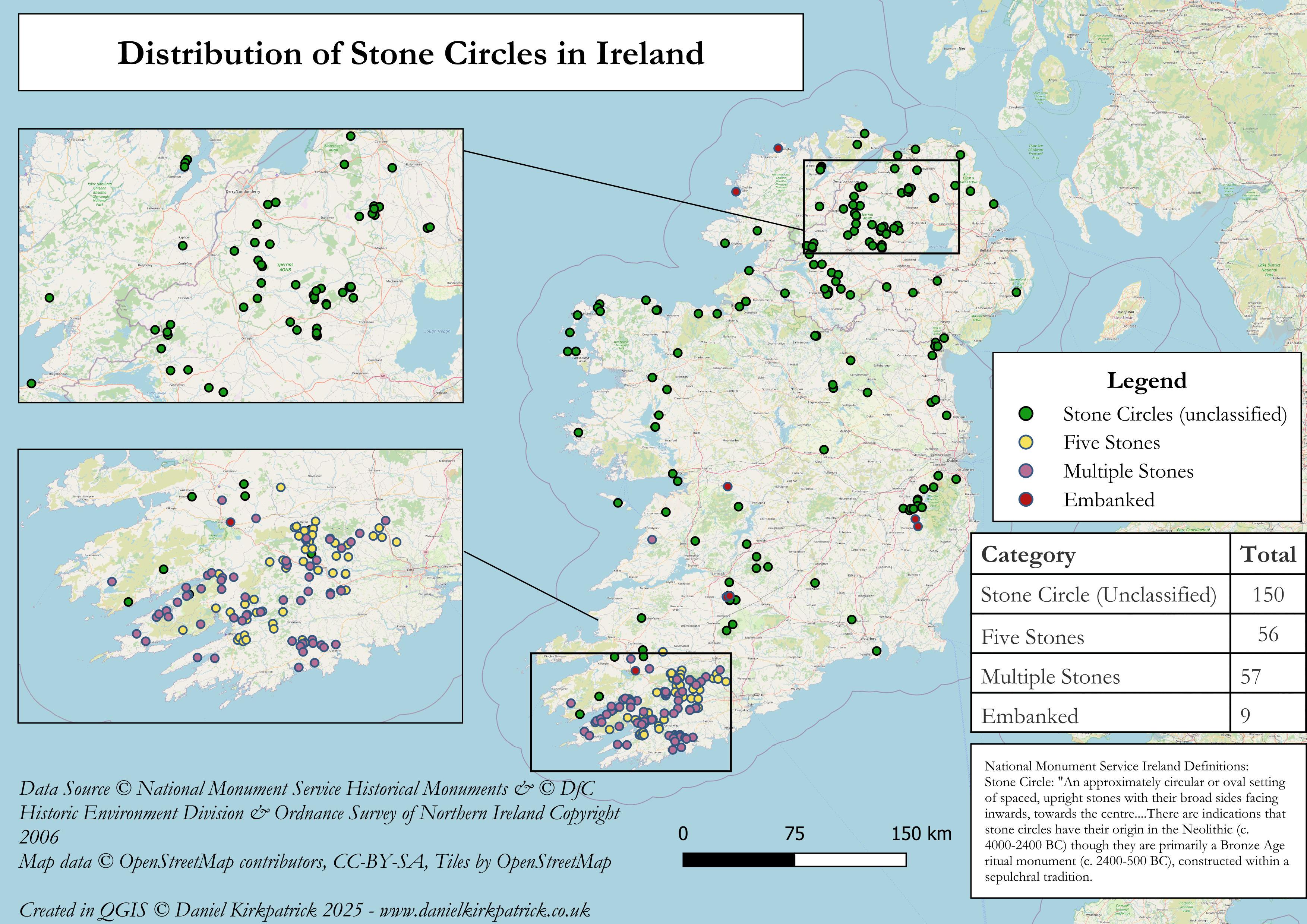
Here are the recorded stone circle locations across the Ireland (over 250). This is probably an obvious point, but these are different from standing stones which are classified separately.
The map is populated with a combination of National Monument Service data (Republic of Ireland) and Department for Communities data for Northern Ireland. The map was built using some PowerQuery transformations and then designed in QGIS. You can see the definitions for the data here.
Anyone know more about the clusters you can see?
I previously mapped a bunch of other ancient monument types, the latest being on forts across Ireland.
Any thoughts about the map or insights about the data would be very welcome. Or any suggestions for future maps.
by Sarquin
1 Comment
For those who want to see the data sources check out NMS here [https://www.archaeology.ie/collections-and-publications/publications/monument-class-and-scope-notes/](https://www.archaeology.ie/collections-and-publications/publications/monument-class-and-scope-notes/) and the UK Open Data here [https://www.data.gov.uk/dataset/46240fa5-db15-469e-b1c8-0460504b951c/northern-ireland-sites-and-monuments-record](https://www.data.gov.uk/dataset/46240fa5-db15-469e-b1c8-0460504b951c/northern-ireland-sites-and-monuments-record) For the tooling, I used QGIS and PowerQuery (Excel).
If you want to see more of my attempts at mapping ancient Ireland you can see them here: [https://www.danielkirkpatrick.co.uk/historical-maps-of-ireland/](https://www.danielkirkpatrick.co.uk/historical-maps-of-ireland/)