
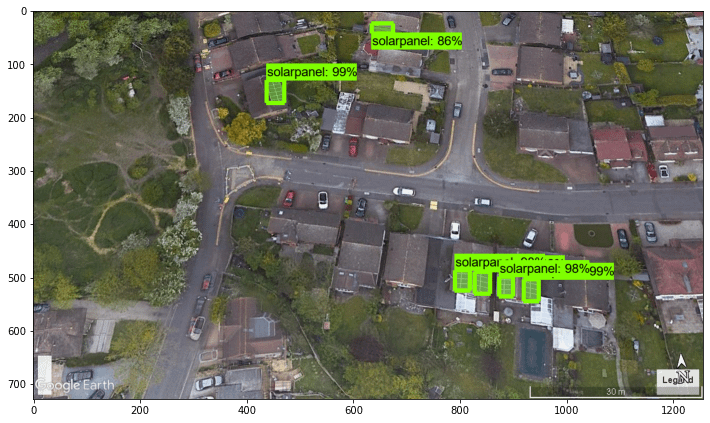
Used a deep learning model to detect rooftop solar panels from satellite images through image segmentation.
The model highlights individual panel regions at the pixel level, revealing interesting spatial patterns across rooftops.
These outputs provide a look into how computer vision can be applied to geospatial data for understanding urban solar adoption.
Created the visuals by overlaying model predictions onto the original imagery.
Posting here for anyone interested in ML-generated visuals, remote sensing, or data from real-world infrastructure.
by Fluid_Dish_9635
2 Comments
For anyone interested in the full breakdown and how I built it, I put together a write-up here: [https://medium.com/gitconnected/how-to-detect-rooftop-solar-panels-in-satellite-images-using-mask-r-cnn-and-tensorflow-9c977fef48da](https://medium.com/gitconnected/how-to-detect-rooftop-solar-panels-in-satellite-images-using-mask-r-cnn-and-tensorflow-9c977fef48da)
Surprised by the one on the left. Why would anyone install a solar panel on the northeast roof section when you have a perfectly clear one facing southwest?